Leica Geosystems has picked up another top accolade, this time at the recent annual 2018 Plant & Civil Engineer magazine Awards.
It was presented with the prestigious ‘Innovation of the Year’ award, sponsored by Cole Groundwork Contracts, during a glittering ceremony, compered by television and radio sports presenter Adrian Logan, at the Crowne Plaza Hotel in South Belfast.
Organised by the Hillsborough based publishers of Plant & Civil Engineer, 4SM (NI) Ltd, it was attended by hundreds of guests and leading figures from the plant, construction and quarry industries. With 14 separate categories, the event is widely regarded as Ireland’s premier platform of recognition for those operating across all sectors of the industry.
Revolutionising the world of measurement and survey for nearly 200 years, Leica Geosystems is part of Hexagon, a global leader in digital solutions. Known for best-in-class products and innovative solution development, professionals in a diverse mix of industries, such as civil engineering, surveying, safety and security, construction and manufacturing all trust Leica Geosystems with their geospatial data.
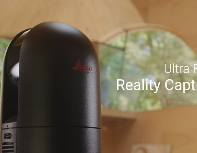
The award was for its Leica BLK360 imaging laser scanner which was first unveiled in November 2016. Leica Geosystems engineers combined an imaging system, angle and distance sensors, and created software to produce a new category of 3D reality capture sensors.
The one-button BLK360 allows anyone who can operate an iPad to create a 360-degree image over a precise 3D point cloud. The BLK360 streams images and point cloud data to an iPad. The iPad app filters the data and moves it along the workflow in real time. Specialty apps like Autodesk® ReCap™ Pro enable the point cloud data to be output to a number of CAD, VR and AR applications. This combination of BLK360 and Autodesk software dramatically expands access to the reality capture process.
Burkhard Boeckem, CTO at Leica Geosystems, said of the product: “The BLK360 brings together exclusive technologies to deliver outstanding performance, all while simplifying the process of 3D image laser scanning and reality capture through the touch of a single button. This has enabled us to create new opportunities for scanning experts and introduce entirely new audiences to laser scanning while uncovering possibilities that were previously unimaginable.”
Prior to this innovation, laser scanning could only be performed by highly skilled professionals with a knowledge of surveying. The BLK360 starts with a single button press. Until now, laser scanners were bulky and heavy. The miniaturised 3D imaging laser scanner cuts the cost of entry into laser scanning by 50 per cent and is the smallest and lightest imaging laser scanner ever made.
Not surprisingly, perhaps, it has won a host of other awards. These include the 2017 iF Design Award, one of the world’s most prestigious design awards, the 2017 Geospatial World Innovation Award, and the 2017 Red Dot Product Design Award. It also was named Product Innovation of the Year at last year’s London Construction Awards and at the 2018 ICE Awards Ireland.
Disclaimer: This article features the Leica BLK360 G1. Explore the expanded capabilities of the latest BLK360 model here.


