
Archileaf Architectural Consultants is saving clients time, money, and headaches in builds with tough zoning restrictions and historical novelty
The city of Denver, Colorado is home to many historic landmark districts full of unique architecture representing nearly 170 years of the city’s evolution and growth.
But when people need to renovate, restore, or add to these buildings, plans are often old, incomplete, or may not even exist at all. And even new builds have to be made under the strict zoning tolerances that honor and protect their historic neighbors.
That means having a precise and accurate representation of buildings and lots as they currently exist is paramount. For Cameron Kruger, Principal at Archileaf Architectural Consultants, a digital twin created with a Leica BLK360 seemed like the best way to achieve that.
He even built his whole business around it.
“It's been a great tool,” Kruger told Leica Geosystems. “I get really excited talking to people about it. I do a lot of residential landmark stuff, and it's amazing what benefits my clients find. It tends to be something where I'm like, ‘Well, here you go. This one thing just paid for my entire service right there.’ So it's kind of hard to argue against using it.”
Kruger gave the example of an architectural project where an as-built drawing had already been created without the use of 3D laser scanning, and the discrepancies between the plans and the real-world conditions of the structure were dramatic.
“They started trying to build off it, and they were just having all these issues — nothing was working out, nothing was lining up,” he explained. “So I went out and scanned it and we found out the entire building was eight inches wider than was drawn in the as-built! And this is in a landmark district. If we find out the building is's eight inches wider, then we're no longer meeting zoning codes. And that could end up causing an entire redesign of that building.”
Kruger began his as-built scanning practice in 2017, using the Leica BLK360 G1 and said his primary deliverables to clients are LGS files for use in Leica TruView and RCP files for use in Autodesk Revit.
This year, he swapped that unit for an all-new Leica BLK360.
“The new BLK360 really fit my niche as a sole proprietor,” he said.
I can fit in three scans in a day where I could only do one before. I'm very into using tools to save time.
Another benefit of these point cloud projects is just how much data and detail he can capture — which he’s found clients appreciating more and more.
“Clients sometimes realize going through the file after the fact that they need some detail they didn’t realize. And I’m able to say, ‘No, we have that information. We just didn't draw it in the CAD file. But we can.’”
While providing point clouds has become a boon for his clients, it’s also turned Kruger into something of an evangelist for 3D laser scanning technology.
“I’m realizing that I need to follow up with these firms and make sure that they are truly understanding all the value that it's bringing,” he said. “I just had a meeting last week with a firm where the main partner that I had worked with left. I was meeting with the two other partners to get them to really understand the service I was providing because they were like, ‘Why can't I just send some guy in with a tape measure and get this information?’”
“By the end of the meeting, they said, ‘Okay, well, we'll definitely give you a call for the next as-built.’”
Mini Case Study: As-built 3D laser scanning identifies major errors on historic house renovation plans
Kruger was kind enough to walk us through a typical landmark project, along with some of the unique challenges posed by this type of construction and how laser scanning with the BLK360 made the difference. Here it is, in Kruger’s words.
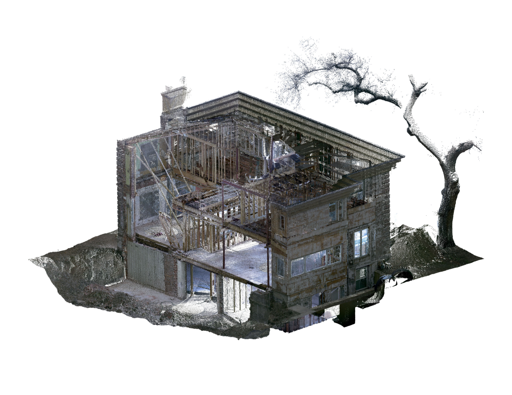
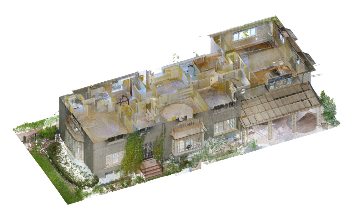
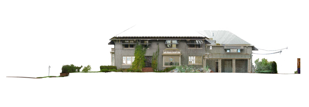
The project was a major residential renovation to a contributing landmark structure in Denver, CO. The house had undergone a previous large-scale renovation, and the plan was to remove everything and retain only the original front and side facades. Since there was barely going to be anything left, the designer decided complete as-builts were not necessary. The designer used the survey for the footprint and took ceiling height and structure depth to determine floor-to-floor heights. Other than that, there was no documentation on the original structure while designing the project.
However, as the contractors started working, things did not appear to line up correctly. The 111-year-old home had some movement over the years. After the contractors completed the demo work, the designer then hired us to complete a point cloud scan of the remaining structure. The resulting scan clarified multiple issues, including some the designer did not know they had.
Here are a few of the issues we discovered.
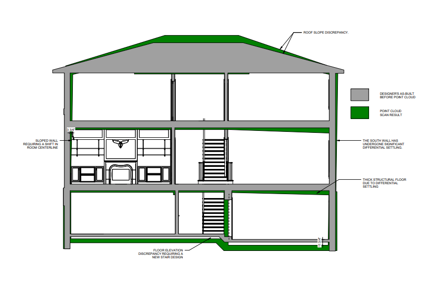
Issue 1: Inaccurate floor-to-floor heights
The architectural drawings had a discrepancy of 11" in the floor-to-floor height. This was due to the architect sending out their least expensive employee to take field measurements with a tape measure. They measured the ceiling height and then the floor joist depth to determine the floor-to-floor height.
What the employee did not realize was the significant slope to the structure due to differential settling over the past century. The original floors had settled about 11" at one side of the house, and a previous remodel added a total of 11" of structure above the decking to level out the floor. This resulted in extra work for the architect to redesign the stairs to fix unforeseen head height and landing issues, and gave their client and contractor a sense of a lack of attention to detail.
This also caused a delay with construction as the contractors waited to frame until all the framing issues were worked out. The delay ultimately cost the architect, contractor and owner time and money.
Issue 2: Tilted walls
The proposed design involved very detailed paneling, with elements centered in the room such as fireplaces, ceiling paneling, lighting, bookshelves, and so on. It was the designer's intent to plaster the original multi-wythe brick walls and panel over that to maintain the room width. Using the point cloud scan, however, we discovered the walls were tilted significantly.
In one room, the wall was tilted 3.5" from top to bottom. The slope of the wall would have made the paneling look crooked in the corners. It was decided that they needed to fur out the walls plumb. Furring out one side made everything off-center by 3", so discovering this before framing was very helpful in avoiding framing out the fireplace and plumbing incorrectly. This effect might not have been noticed until the project was trimmed out.
Issue 3: Foundation problems
The contractor had their surveyor stake for the new addition foundation. After forming the foundation, however, the contractor called the designer because something did not seem right.
Upon scanning the foundation, it was discovered all the foundations were shifted 10" south. Through the use of the point cloud scan, we discovered the project drafter squared up the site in their design documents while the surveyor used the dimensions between the foundation and property line to stake the foundation.
Issue 4: Roof slope
The intent of the addition was to match the existing roof slope and eave elevation. The designer had drawn the roof with a 3/12 slope. Using the point cloud, we realized the roof was actually a 4/12 slope.
Long story short, the architect now uses point clouds generated from 3D laser scanning to document the existing conditions on every project and throughout the construction process to check and verify their drawings and construction.
Disclaimer: This article features the Leica BLK360 G1. Explore the expanded capabilities of the latest BLK360 model here.


