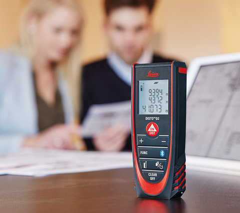
How many zoom levels does the Leica DISTO X6 have?
The digital Pointfinder built into the device has a zoom camera with the zoom levels 1x, 2x and 4x. The selected zoom level is shown on the left side below the status line in the display. To change from one zoom level to the next zoom level, you can press the zoom button (up arrow key)or use a corresponding gesture on the touch screen.
Can images be stored with the Leica DISTO X6 and what is the resolution?
Measurements can be saved with the right selection key as so-called reports. If the Pointfinder is switched on, the device saves not only the measurement data but also the image of the last measurement taken.
Furthermore, when using 3D Data Capturing with the Pointfinder activated, the respective images of the measuring points are also saved.
The resolution of each image is 240 x 240 pixels.
How can images be downloaded from the Leica DISTO X6 to a computer?
The images can be uploaded onto the computer via USB interface. To do this, connect the DISTO to the computer via a USB-C cable, the DISTO will be recognised automatically. Using the file manager (e.g. Windows Explorer) the photos can now be copied to the computer. Please note that no data can be uploaded onto the DISTO and it is also not possible to delete data on the DISTO via computer. The measurement data with pictures can be deleted on the DISTO in the "Reports".
Can the brightness be adjusted in the digital Pointfinder?
Yes, when the digital Pointfinder is switched on, the brightness of the camera image can be adjusted with the right or left arrow keys.
Why is the crosshair not in the centre of the viewfinder at short distances or why does it jump from the centre of the image to the laser dot after a short time?
Since the laser outlet on the housing is not congruent with the camera optics, a so-called parallax error occurs. This means that the laser dot is not centred on the image on the display at short distances. However, the X6 has software that detects the laser dot and then corrects the crosshair on the display. This also works in poor lighting conditions and thus ensures that the position of the laser dot is measured independently of the parallax, even if it is not visible.
How accurate is the tilt sensor in the Leica DISTO X6?
The accuracy of the tilt sensor is ±0.2° to the bottom of the unit's housing. The maximum possible deviation from the laser beam is ±0.2°. This applies at room temperature (20°C - 30°C). At other temperatures, the maximum possible deviation can increase by +/- 0.1°.
Which different tilt units are integrated in the Leica DISTO X6?
Two inclination units can be set on the Leica DISTO X6. The user can select the submenu "Angle units" in the settings and set the desired unit (°, %).
What is the range covered by the tilt sensor of the Leica DISTO X6?
The integrated tilt sensor of the Leica DISTO X6 works over 360° with a maximum lateral tilt of < ±10°. If the device is held tilted more than < ±10° sideways, the info code "i156" appears indicating that the device is tilted too much.
Can the tilt sensor in the Leica DISTO X6 be calibrated by the user?
The zero point of the built-in tilt sensor can be recalibrated. In the settings of the unit there is a submenu "Tilt calibration". After selecting the submenu, the user is guided through the calibration.
Please carry out the following steps:
Place the unit on an absolutely flat surface with the type label facing downwards.
Press the "ON/DIST" button. The unit will beep to confirm that the measurement has been taken.
Turn the unit horizontally by 180° with the type label facing downwards.
Press the "ON/DIST" button and perform the second measurement. The unit beeps to confirm that the measurement has been taken.
Place the unit on the surface with the lens facing up.
Press the "ON/DIST" button and perform the third measurement. The unit beeps to confirm that the measurement has been taken.
Continue to rotate the unit horizontally 180° with the lens facing up.
Press the "ON/DIST" button and perform the fourth measurement. The unit beeps to confirm that the measurement has been taken.
After confirming the successful calibration in the display, the unit switches back to the basic mode. The calibration is completed.
Can the Leica DST 360-X adapter be calibrated by the user?
Connect your Leica DISTO X6 to the Leica DST 360-X adapter. In the settings of the device there is a submenu "Calibration". Two options are displayed - Tilt Sensor Calibration and Adapter Calibration. Select the "DST 360-X Calibration" option and follow the steps below:
For levelling, the unit must be within a tilt range of ±5°.
Roughly level the device on the Leica DST 360‑X horizontally. Aim at a target in approximately 5 m distance.
Press the "ON/DIST" button. The unit will beep to confirm that the measurement has been taken.
Flip the device by 180°. Then rotate the device horizontally by 180° and aim very precisely at the same target with the screen facing down as in the previous measurement.
Press the "ON/DIST" button and perform the second measurement. The unit beeps to confirm that the measurement has been taken.
Turn the device horizontally by 180°. Then flip the device by 180° and aim very precisely at the same target with the screen facing upwards as in the previous measurement.
Press the "ON/DIST" button and perform the third measurement. The unit beeps to confirm that the measurement has been taken.
Flip the device by 180°. Then rotate the device horizontally by 180° and aim very precisely at the same target with the screen facing down as in the previous measurement.
Press the "ON/DIST" button and perform the fourth measurement. The unit beeps to confirm that the measurement has been taken.
After confirming the successful calibration in the display, the unit switches back to the basic mode. The calibration is completed.
Tip: To aim more accurately during calibration and avoid errors, use a white surface with a black, wide ring as the aiming point. The diameter of the white inner area should be approx. 7mm. This makes it easier to see from the reflection of the laser whether you are aiming exactly in the centre of the target point.
Why can I carry out a levelling with the Leica DISTO X6 or do I automatically get prompted to do so for certain functions?
If the measurement results refer to a horizontal plane (e.g. absolute measurements or measurements for CAD), the device must be calibrated beforehand. This compensates for errors caused by a slightly inclined surface. The range for levelling is +/-5°.
What measures can be taken to increase the accuracy of measurements with an X6?
Use a stable support or tripod with Leica DST 360-X adapter. Trigger measurements only via the touchscreen (tap the function icon above the DIST button), use measurement triggering with gestures (must be activated in the device settings) or trigger the measurements using the Timer.
Which representations do I get when using 3D Data Capturing?
Depending on the measurements, 2 or 3 different DXF files are created:
2DG --> This is the floor plan.
2DW --> This is the view. However, this file is only created if there is a horizontal offset of >10cm between the first and the second measurement. Otherwise, no X-axis can be determined to calculate the view.
3D --> This is a 3D drawing.
At the same time, csv files and data points with coordinates are also saved for later import into special software or for further processing in Excel.
Please note: The DST 360-X adapter is required for 3D Data Capturing.
According to which criteria are the axes created in the DXF file?
The first measured point corresponds to the origin of the drawing. The second point then determines the orientation of the X-axis. The Y and Z axes are arranged at right angles to each other with respect to the horizontal plane (leveling).
If the second point measured is less than 10 cm away from the first point measured in the horizontal direction, the DISTO X6 will display a warning and a second point must be measured again to determine the X-axis.
Please note: For 3D Data Capturing the DST 360-X adapter is required.
No images are saved during 3D Data Capturing. Why is this the case?
Basically, only photos are saved when the Pointfinder is switched on.
How can I download the DXF data from the Leica DISTO or delete it on the device?
The DXF data are stored on the device in a respective folder (incl. csv files and associated photos if Pointfinder is switched on). These can be easily downloaded via a USB cable. Deleting the folders with files on the DISTO can only be done directly via the dedicated function on the DISTO.
What area is measured when using the Smart Area function?
The actual area is measured with this function. If the area is inclined (e.g. roof), the actual area is determined. Several areas can be added and subtracted with the + and - keys. These areas do not have to lie in one plane, so the area of e.g. complex roofs can also be determined.
Please note: For Smart Area and other point-to-point measurements, the DST 360-X adapter is required.
Can I measure the area of round objects?
The area of round rooms cannot be measured exactly. Since the Smart Area function measures up to 30 corner points, a very good approximation can be obtained by measuring several points along the arc.
Please note: For Smart Area and other point-to-point measurements, the DST 360-X adapter is required.
Is it possible to get detailed information on the measurements carried out?
Yes, it is possible to get detailed information with the Leica DISTO X6. If detailed results are available, arrows appear in the top centre of the display. It is possible to scroll through the results with the arrow key up or down.
The Leica DISTO X6 has the Measure in Picture functions. What is the accuracy of these measurements?
The accuracy depends very much on how the function is used. Best measurement results are achieved when the object to be measured is as large as possible on the DISTO display. In these cases the accuracy is approx. 1% of the object to be measured. This applies to measurements of widths, diameters and areas in the image.
Which accessories are recommended for the Leica DISTO X6?
Leica Tripod TRI 75, TRI 100, TRI 120
For measuring long distances, we recommend the use of a tripod. A tripod enables accurate and precise aiming of the measurement target even over long distances. We recommend using the Leica tripod especially in conjunction with the DST 360-X adapter.
Leica TRI 75
This is the most compact tripod for low working heights. When folded, this tripod is approx. 45cm long.
Leica TRI 100
This tripod also has a tripod head and a greater possible working height.
Leica TRI 120
Height can be solidly adjusted with the clamp locks and the 180° folding tripod legs make the tripod extremely compact.
DST 360-X adapter
To achieve higher accuracy, we offer the DST 360-X adapter, a stable adapter with fine drive for comfortable and precise aiming. It facilitates aiming, especially at long distances, and leads to smaller deviations in indirect measurements. It enables P2P/P2L measurements and the capturing of 2D and 3D data for further processing in CAD programs.
Target board
For measurements especially outdoors and in bright surroundings, it is very helpful to use a target plate. We offer different variants in our range of accessories. Especially for measuring ground points, even over longer distances, we recommend using the TPD 100 kit.
What measurement accuracy is achieved with the direct horizontal function?
For example, if an angle of 10° and a distance of 10 m is measured, the max. error for the direct horizontal distance (fd) is 3 mm.
To get the best result with indirect measurements, taking into account the deviation, the unit should be held as flat as possible.
The error for the horizontal distance (fd) and the error for the height (fh) can be calculated as follows depending on the measured angle:
fd = error of the horizontal distance
fh = error of the height
d = measured distance
a = angle at which the distance is measured
fa = possible angular error
fd = d * cos (a) - d * cos (a + fa)
fh= d * sin (a) - d * sin (a + fa)
You can see further details and a table of the resulting errors under the heading FAQ Measurement Accuracy.
Is it possible to enter a value in the unit that is automatically added / subtracted to each measurement? (offset)
Yes, in the settings, the icon "Distance offset" can be selected and a value can be entered, which is then added to or subtracted from each measurement. If an offset value is entered, this is shown in the display with a small triangle and a plus or minus next to the laser symbol.
How does the user know that the measurement is not yet complete?
If the measurement is not yet completed, an hourglass is shown in the status bar of the display. The hourglass is shown in the display until the measurement is completed. The unit should not be moved beforehand!
How can I get an extra year warranty for my Leica DISTO X6?
The standard 2-year warranty we give on our laser distance meters can be extended by an additional year if the unit is registered on our website www.disto.com within eight weeks of the date of purchase. If the product is not registered, a two-year warranty applies.
What does it mean when a number appears on the display?
These are so-called message codes. They appear when a measurement could not be carried out successfully. The user himself can change the measurement situation to achieve a successful measurement. Below you will find the table with the recommendations from the instructions for use:
|
No.
|
Cause |
Correction |
|
156 |
Transverse tilt greater than 10° |
Hold the instrument without any transverse tilt. |
|
162 |
Calibration error |
Make sure the device is placed on an absolutely horizontal and flat surface. Repeat the calibration procedure. If the error still occurs contact your dealer. |
|
204 |
Calculation error |
Perform measurement again. |
|
240-245 |
Data transfer error |
Connect device and repeat procedure. |
|
252 |
Temperature too high |
Allow device to cool down. |
|
253 |
Temperature too low |
Warm device up. |
|
254 |
Battery error |
Charge batteries. |
|
255 |
Received signal too weak, measuring time too long |
Change target surface (for example white paper). |
|
256 |
Received signal too high |
Change target surface (for example white paper). |
|
257 |
Too much background light |
Shadow target area. |
|
260 |
Laser beam interrupted |
Repeat measurement. |
|
298 |
Battery status poor |
Replace battery to avoid severe damage on the device. |
|
299 |
Hardware error |
If this message continuously appears, the device must be serviced. Ask dealer for help |
|
300-303 |
Error with Leica DST 360‑X adapter |
Repeat procedure. If the message still occurs, contact your dealer. |
|
301 |
The device has been moved, levelling not valid anymore. |
Perform levelling again. Levelling with invalid levelling is possible but it affects the accuracy. |
|
304 |
Distance for calibration of Leica DST 360‑X is out of range |
Select a distance of about 5 m from the target. |
|
305 |
Aiming error during Leica DST 360‑X calibration |
Repeat procedure and make sure for precise aiming. |
|
306 |
Leica DST 360‑X calibration failed |
Repeat calibration process. |
|
307 |
Aiming error during Leica DST 360‑X calibration |
Repeat procedure and make sure for precise aiming. |
How do I activate the key lock?
The key lock can be activated in the settings. To deactivate it when the unit is being switched on, press the = button.
How do I deactivate the key lock?
The key lock can be deactivated in the settings. To deactivate it when the unit is being switched on, press the = button.
Measuring with a tripod - what must be taken into account?
The measurement reference must be adjusted for tripod measurement. For this purpose, as soon as the laser has been activated (pointing mode), you must select the button for setting the measurement reference (down arrow key). Here you can now set the measurement reference to tripod. After switching off, the unit goes back to the standard setting (measuring from behind).
What is measured during Height Tracking?
Height tracking shows the indirect height. The combination of slope and distance measurement on walls opens up the possibility of this indirect calculation. It is a useful function when you cannot measure the height directly or when different height measurement points have to be measured on the same vertical line.
What does ISO 16331-1 tested mean?
If products and services meet our expectations, we take it for granted and do not think about the role of standards. However, if standards are not present, we notice it quickly. We notice when it turns out that products are of poor quality and do not deliver what they promise. An ISO standard provides tested quality and reliability for products.
The range and accuracy of laser distance meters depends very much on the lighting conditions and the reflectivity of the measurement target. It is important to Leica Geosystems that the performance of the devices is not only maintained under perfect laboratory conditions, but above all in everyday use on the construction site. That is why, in cooperation with external experts, we have developed a standard according to which laser distance measuring devices can be tested and thus compared with each other. Devices that have been tested according to ISO 16331-1 deliver what they promise. You can find more information on our website: www.disto.com.
How can I put my favorites (most used functions) on the self-programmable buttons?
In the settings, select the option Favorites. Now select the function you want to use as your favorite function. Then press the button on the left or right under the display to which you want to assign this function.
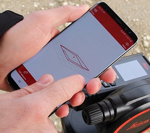
What Bluetooth® technology does the Leica DISTO X6 use?
The unit uses Bluetooth® 5.0 (also known as Bluetooth® Low Energy) technology. The device can be used to transfer data to smartphones or tablet PCs that have Bluetooth® 4.0 or higher. The devices must also have an operating system version that supports this Bluetooth® standard, this is the case for iOS, Android 4.3 or higher and Windows® 10 and 11.
Can measurement data from the Leica DISTO X6 be transferred to Apple mobile devices?
Yes. With the Leica DISTO X6 it is possible to transfer measurement data to Apple mobile devices (iPhone 4S, iPhone 5, iPhone 5S, iPhone 5C, iPad 3, iPad 4, iPad mini, iPod touch (Gen.5) --> Bluetooth® 4.0).
It is possible to use apps from the App Store that support DISTO devices (e.g. the DISTO Plan app from Leica Geosystems). Alternatively, the DISTO can also be connected as a keyboard via the Bluetooth® Manager of the iOS device. With this type of connection, the DISTO works like a keyboard and measurement data can be sent directly to the position of the cursor in any app.
This mode must be activated in the DISTO in the Bluetooth® settings menu.
On my iOS device, after transferring data in keyboard mode from my Leica DISTO, the keyboard no longer appears.
Press the +/- button on the DISTO for 1 second. The keyboard will immediately appear on the display of your iOS device.
Can measurement data be transferred from the Leica DISTO X6 to an Android device?
Yes. With the Leica DISTO X6 it is possible to transfer measurement data to an Android device. The installed operating system must be version 4.3 or newer. Measurement data can be sent to devices that have Bluetooth® 4.0 or higher.
It is possible to use apps from the App Store that support DISTO devices (e.g. the DISTO Plan app from Leica Geosystems). Alternatively, the DISTO can also be connected as a keyboard via the Bluetooth® Manager of the iOS device. With this type of connection the DISTO works like a keyboard and measurement data can be sent directly to the position of the cursor in any app.
This mode must be activated in the DISTO in the Bluetooth® settings menu.
Can measurement data be transferred from the Leica DISTO X6 to Windows computers?
Yes, with the Leica DISTO X6 it is possible to transfer measurement data to Windows computers. The Leica DISTO X6 is recognised as a "keyboard". To do this, simply connect the DISTO in the Windows device manager. Now measurement data can be transferred from the DISTO to the cursor position of any program. The corresponding modes must be set in the DISTO device in the Bluetooth® settings menu. The Windows computer must have the operating system Windows® 10 or higher installed and must have Bluetooth® 4.0 or higher. There are also Windows software programs that support DISTO devices (e.g. the DISTO transfer from Leica Geosystems).
My software only supports commas as decimal points, but not dots. Can this be set in the Leica DISTO X6?
Yes, this setting can be made. This setting can be made in the Bluetooth® settings menu in step 3.
I have to fill out a form on the Internet or a table. Here it is necessary to jump to the next input field after each measurement with the tabulator or Enter key. Is this option available with the Leica DISTO X6?
Yes, this setting can be changed. In the Bluetooth® settings menu in the penultimate step, this setting can be made (Tab, Enter or without addition).
I need the navigation keys to go to the appropriate input cell in my table. Can I do this from my Leica DISTO X6?
Yes, this is possible. When the DISTO device is connected to a smartphone or a tablet or a computer, the content of the selection buttons changes to support the corresponding Bluetooth® communication. The left selection button can be used to switch the navigation function on or off.
Is it possible to transmit images via Bluetooth®?
No, only lengths, areas, volumes, slopes and point data (e.g. spatial coordinates) can be transmitted via Bluetooth®.
Do I need any special software for data transfer via DISTO?
If the DISTO is connected via Bluetooth® and keyboard mode, no additional software is required. For all other types of connection specific software is required! Regarding Windows, Leica Geosystems provides the DISTO transfer, which can be downloaded from our website.
How long does it take to charge the Li-Ion batteries in the Leica DISTO X6?
This depends on the charger used. With the included charger, it takes approx. 3 hours to charge the Li-Ion batteries.
Is it possible to replace the Li-Ion batteries in the Leica DISTO X6?
The Li-Ion batteries can only be replaced in case of service. In this case, please contact your dealer.
Can the software version on the Leica DISTO X6 be renewed?
Yes, there is the possibility to update your DISTO via the DISTO Plan App. Connect your DISTO to the DISTO Plan App and go to "My devices". Select your device and click on "Check for updates". If a new update is available, simply confirm that the update should be installed and wait a short moment.
Are apps and software offered by Leica DISTO?
Yes, Leica Geosystems offers the DISTO Plan App and DISTO transfer software.
How can I trigger the measurements with gestures and when should I use this function?
Click on the Gesture icon in the settings to activate this function. Then select any measurement function and, with the laser switched on, move your hand or another object through the laser beam at a distance of 5-25 cm. If the measurement is not triggered, repeat the process at a slightly slower speed.
The Leica DISTO X6 can store up to 300 reports. What is meant by this?
Reports are measurements and results that can be saved as a list with date and time. If the Pointfinder is switched on, the last image is also saved. The lists can be downloaded via USB-C cable as a jpg or csv file. To create a report, press the "Save" button on the results screen.
What is the IP65 protection class?
IP65-certified housings provide complete protection against the ingress of solid objects and against low-pressure water jets from all directions, as well as against condensation and splashing water. The unit is therefore suitable for most outdoor applications.
Please note: The unit cannot be submerged under water. The IP67 protection class is intended for these conditions.
What can the new Point-to-Line function be used for?
This function is useful for referencing points relative to a known line, e.g. a house edge or property boundary. This is especially helpful if the documented points are no longer visible or accessible later.
In addition, when tracking is activated, the distance between the measured point and the reference line is displayed in real time. This makes the function particularly helpful when you are trying to find the previously measured point.
Please note: For Point-to-Line and Point-to-Point measurements the DST 360-X adapter is required.
What is measured with the Height Profile?
The Leica DISTO X6 also allows you to measure a height profile. This involves first measuring to a reference height (e.g. a survey point or a manhole cover which serves as a reference height). This reference point can then - if necessary - be given a height value known for this purpose (e.g. 125.232m above sea level). The subsequently measured points then refer to the absolute height including the height value of the reference point. To enter this height value, you must press the right selection button before measuring the reference point and enter the valid value.
Can I also switch off the digital Pointfinder, e.g. because it is distracting or to reduce energy consumption?
Yes, if you do not need the digital Pointfinder, you can also deactivate it. To do this, you can deactivate the Pointfinder in the settings or press the zoom button for approx. 2 seconds while the laser (pointing mode) is activated until the camera image disappears.
This setting remains even after switching the unit off and on. To activate, simply repeat the above steps.
After switching on the unit, the error message i298 appears and/or the battery cover on the underside of the unit is bulging. What should be observed?
As with any electronic device with a lithium battery, it can never be completely ruled out that the battery will begin to deform after some time and will no longer be of the same quality as when it was new. In this unlikely case, please stop using the device and replace the battery. Please contact your dealer for this.