 RTC
RTC
 BLK360
 BLK360 SE
 BLK2GO
 BLK ARC
 BLK2FLY
 BLK3D
BLK3D
 Accessories

After the conflict in Ukraine began in 2022, the Ukrainian government gave special permission to organizations like UNESCO, ICOMOS, and ICCROM, with experts in 3D scanning, to capture buildings of cultural importance with 3D laser scanners.
Major cities and communities throughout Ukraine have suffered significant damage since the conflict began, with the architecture and cultural heritage of numerous churches, buildings, and centers of community in danger of being completely destroyed.
In response, in August of 2023, UNESCO, together with its advisory bodies, the International Council on Monuments and Sites (ICOMOS), and the International Centre for the Study of the Preservation and Restoration of Cultural Property (ICCROM) launched the joint project “Support for Ukraine in Education and Culture Through UNESCO," funded by Japan, to enhance the capacities of Ukrainian heritage professionals and to digitally preserve and utilize 3D models of UNESCO World Heritage sites.
A digital mission
The collective goals were set, with ICOMOS assembling and sending its expert teams on several joint missions with UNESCO to Ukraine in 2023 and 2024, that would:
-
Scan and capture, to 3D scanning verification levels and scanning codes, several sites in Ukraine – from churches to theaters with 3D LiDAR scanners.
-
Train Ukrainian heritage professionals to scan with laser scanners so documentation can continue after the project ends.
-
Deliver the 3D data of various sites to Ukrainian government authorities (Ministry of Culture and Communication) for utilization in existing emergency plans, impact reports, and reconstruction.
When the ICOMOS teams were planning which sites to scan and document, they decided on using the Leica BLK360.
“I have been scanning since 2003, and the BLK360 is my go-to when capturing challenging places and providing easy training,” says Mario Santana Quintero, ICOMOS team lead expert and Professor of Architectural Conservation and Sustainability Engineering at Carleton University. He continues: “I find 3D scanning has become an essential tool for conservation of historic places.”
Scanning in an active war zone with the BLK360
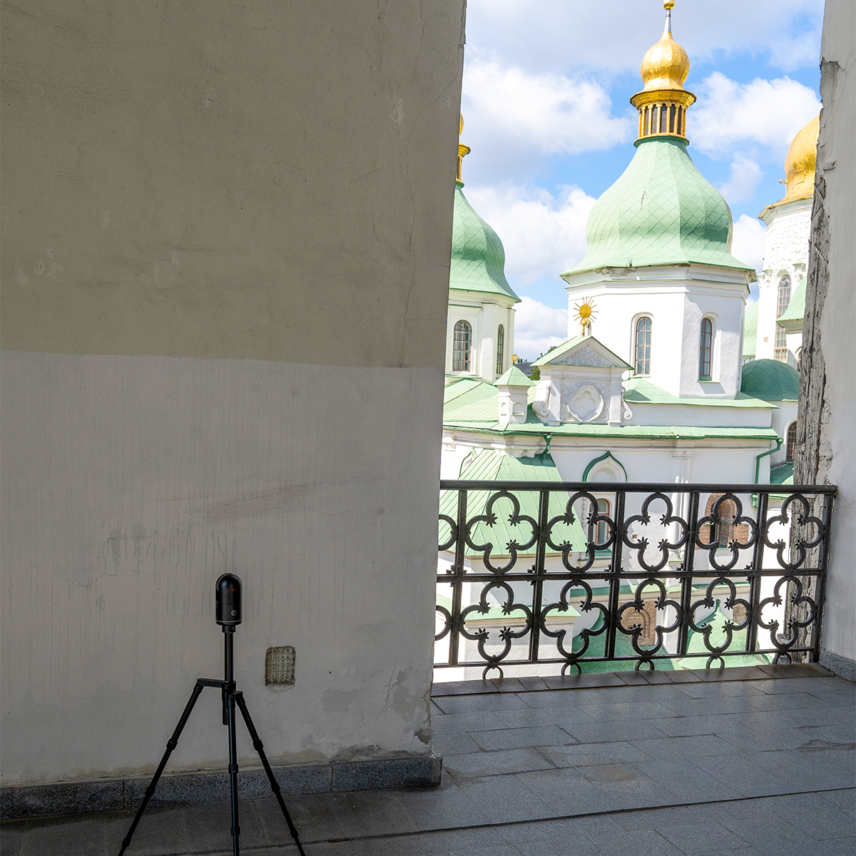
Without disclosing the exact locations of the buildings the teams scanned, the focus of the sites was community hubs filled with history for Ukrainians and deep cultural touch points.
When documenting these sites, Santana stressed that the goal wasn’t only to capture the spaces for preservation’s sake but to deliver the data for application toward engineering needs and safety precautions like detailed existing plans and emergency escape routes.
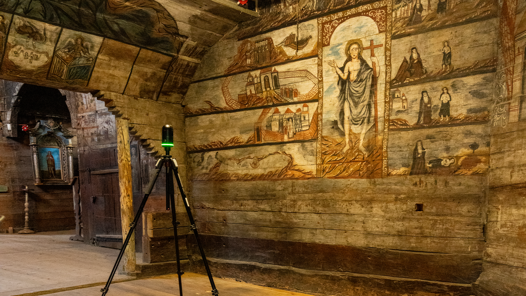
For one theater in particular, damage caused by nearby missile attacks had disrupted the foundation and caused extreme cracking to the building. Santana emphasized, “Point cloud data captured with the BLK360 is particularly useful for assessing the structural impact of the ongoing conflict.”
With this data, teams in Ukraine can examine the data of the building model and move it into various applications to inform how to rebuild and restore damaged sites to their original architecture and prepare emergency preparedness response plans.
When capturing churches, the goal was to capture as much detail of the grounds as possible with an emphasis on not just the church building but also the surrounding area so that the 3D model existed amongst other landmarks, such as streets, to centralize its location.
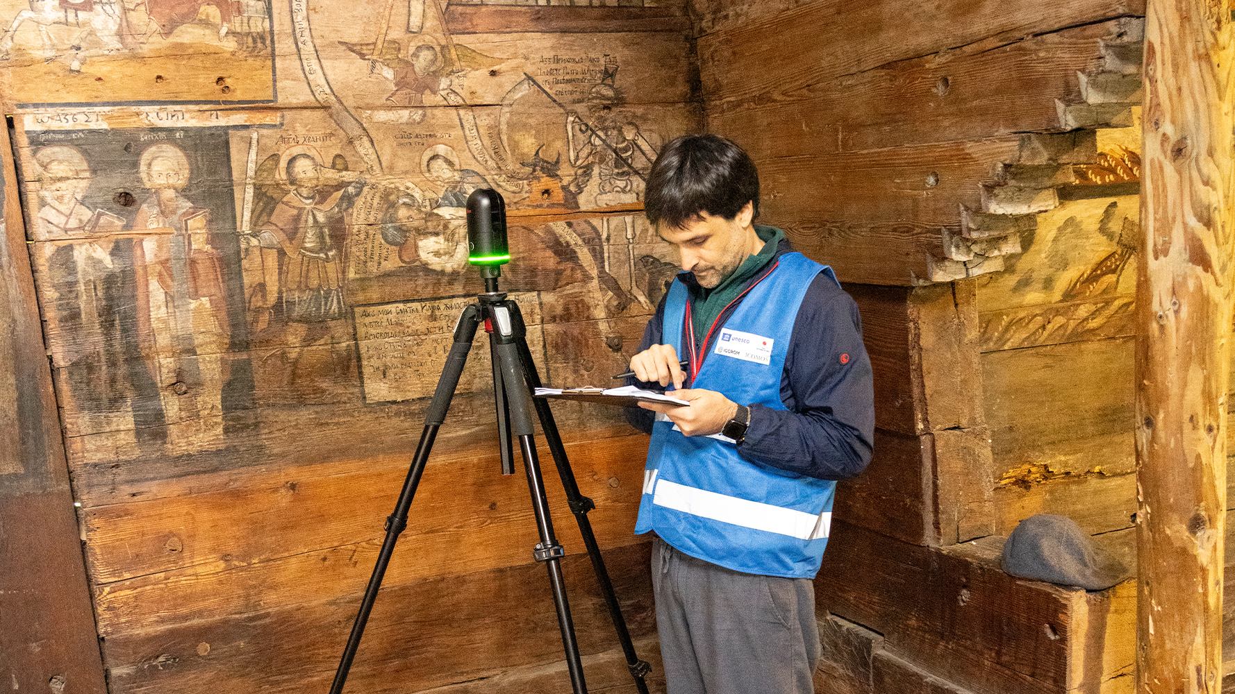
The team was also intent on capturing more fragile and intricate details of churches with wooden architecture and special details like bells and arches.

Training local team members
A big goal of the initiative was to empower Ukrainian professionals in national and local institutions with skills in scanning and capturing data with the BLK360 and then transferring that data into multiple applications to deliver on future restoration and building safety. The feedback Santana recalls from the local teams in Ukraine using the BLK360 was their surprise with its intuitive nature. “When scanning with the Ukrainian team, it was super easy for everyone to work with the device. Its interface is easy to grasp and teach,” Santana said.
The BLK360’s role from site to site
When explaining why the team decided on the compact terrestrial laser scanner, Santana offered the immediate benefits he knew the BLK360 could deliver, mainly, its speed, its size, and the laser scanner’s precision. “With the BLK360, these three key features were a must for this challenging heritage documentation project that involved complex logistics, urgency, and quick acquisition,” Santana said.
Santana knew from previous experiences documenting and scanning areas in volatile conditions that he and the team needed a laser scanner that was fast but also compact and agile enough for their travels. “For Ukraine, we took airplanes, trains, and buses from site to site with the BLK360. Its compact form made it ideal for transportation,” he noted.
The team sent to Ukraine also knew whichever scanner they chose had to be capable of capturing a great level of detail in a very short time.
“When it comes to working in a war zone and also in places of worship like these important religious sites, where the community requires the use of these churches,” he added, "the BLK360 offered the needed speed to complete the job fast.”
With the laser scanner, the team could quickly scan, acquire the necessary data, and then move on from the spaces without disturbing the various functions within the buildings.
The project was a huge undertaking, calling for multiple trips into Ukraine with various needs for each site as logistics were constantly changing. Santana pointed out that "the BLK360 was crucial for us. Although it is small, it is a powerful device offering excellent quality at mid-range distances."
Heritage documentation and 3D data capture
During his heritage documentation career, Santana has traversed the world, working in several countries, including, Colombia, Afghanistan, Morocco, the United Arab Emirates, Egypt, Sudan, Syria, Iraq, and Jordan. With his projects and training activities for emerging professionals and students, Santana believes “this work must go beyond making 3D models.”
He continues, “The 3D data captured must allow for critical engineering decisions to be made on how to physically repair, maintain, protect, and even reconstruct sites affected by conflict.”
With the permission and collaboration of Ukraine’s Ministry of Culture and Communications in facilitating and supporting the project on the ground, UNESCO, ICOMOS, and ICCROM continue the initiative with a projected end date in spring 2025.
Read more about the team’s joint efforts to support rehabilitation for Ukrainian sites and enhance emergency preparedness for central city churches.
Learn more about the team’s chosen BLK360 laser scanner here.