
The last decade has brought significant changes to the way utility organisations operate. With an estimated (conservative) 1.5 million people added to the global population each week and 54% of the world’s population living in urban areas more infrastructure is needed to support existing networks to serve more people in increasingly dense areas where space is at a premium.
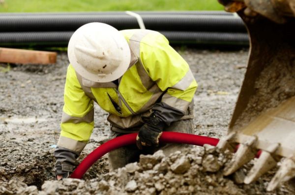
Utility organizations face huge challenges daily as their existing infrastructure networks become overloaded through ever-increasing demand from the end-user. The need to maintain, repair, replace and expand these networks relies increasingly on knowing exactly where their assets are in the ground both positionally and how deep they are. Accurate positions and up-to-date record information allow greater visibility for utility organizations assets. Combined with digitally-based records and easier sharing of information, older paper-based workflows are suddenly transformed into more efficient seamless operations. The exchange of information from field to the office (and vice-versa) becomes near instant. Paper still has its place because there are places where technology still doesn’t reach, but utility assets are present.
This instant visibility and exchange of data combined with digital network information moves you to the next level. Increased productivity, improved health and safety, adherence to best practices, and improved customer service are some of the benefits. Combining all those mentioned above allows project timelines, where that luxury exists to be maintained, for the emergency repair and maintenance sector, the opportunity to plan and safely execute the works at short notice and give workers the correct tools for their task based on having correct and accurate record information at hand.
When it comes to detecting buried utility assets such as pipes and cables, we have two technologies to choose from; the more traditional Electromagnetic Locator devices (EML) or Ground Penetrating Radar (GPR). They are very different from each other but share a familiarity in that they use signals transmitted into the ground to find things. So, the question that comes to contractors is which tool is the most appropriate for me?
Leica Geosystems offers utility detection products that use both technologies. Choosing which technology or product is right for you depends on a few things, but then again, doesn’t every decision we have to make in life? Let’s start with the simple questions to decide which detection product is more suitable:
- The purpose of the detection, what do you want to achieve?
- Locate only, locate and record information, cm accurate or mark on the ground?
- The material of the utility, are they metal, concrete, plastic, etc.?
- The inside of the utility (hollow or not), empty ducts, etc.?
Suppose, your sole purpose is to detect underground power cables or even just a specific power cable. In the first instance, you should use an Electro Magnetic Locator. In most cases, where there is flowing current in the cable, an EML locator will do what you need it to do, used correctly with all modes and a transmitter, then even power cables with no flowing current can be detected. The common misuse of EML locators around non-current carrying cables is the thing that can make excavating difficult. Damaging power cables is not only very dangerous, the repairs can be expensive, time-consuming and, more importantly, massively disruptive for the end-user. If the purpose of the detection is to avoid cable damage during excavation, an avoidance EML would be the best, most suitable option as it is easy to use, cost-efficient and practical. Leica DD series provides fast and accurate cable location and makes the detection an easier task with state-of-the-art digital signal processing.
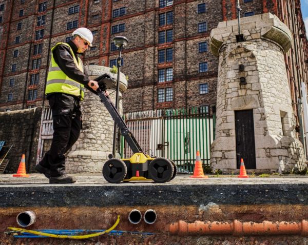
If the detection task is to track a cable over a long distance to map it, the more suitable product would be a Leica Ultra precision locator. The benefit of a compass on the display guides the user to a precise location for the power cable and gives the user its direction and other information Leica Ultra can also be connected to the Leica Zeno FLX100 smart antenna for precise positioning of the cables. With Leica Ultra, FLX100 and Zeno Mobile app, users can locate and digitally map underground assets fast, precisely and efficiently with an RTK connection. The FLX100 streams centimeter level GNSS positions to the Zeno Mobile app running on your own smartphone or tablet. This app is intuitive and easy to use, when paired with the Leica Ultra via Bluetooth, you can capture the geographic location and depth of the underground asset at the same time.
But what about non-metal utilities such as fiber optics, plastic and concrete pipes? In such instances, Leica Geosystems offers the user a selection of utility detection radars, Leica DSX and Leica DS2000. GPR is the most suitable choice and both systems offer the user options for avoiding utility damages or digitally mapping utilities for planning and surveying tasks.
Which translates to:
- GPR works by transmitting and receiving a signal into the ground from the system antenna. The received signal contains information from any target reflections along the signal path and where in time the reflection occurred. This is then translated to position and depth by the GPR software.
Information collected from a GPR will contain metallic targets, non-metallic targets and below ground strata information in the form of reflected objects and boundaries.
- EML works by detecting the electromagnetic field generated by flowing Alternating Current (A.C) along power cables, for example, or alternatively, the energy from low-frequency communications signals, which is re-radiated from metallic services. This simple form of receiver only detection is known as Passive detection. Alternatively, we can substitute the freely available Passive signals with our specific signal at a known frequency with the use of a transmitter; thus, in the case of a metal service, the signal is applied by two techniques, induction (transmitter placed on the ground directly above a known utility) and direct connection. Where there are suitable direct connection points, then a signal clamp or connection leads connected to a transmitter are used to apply the signal by accessing the service. For plastic, concrete, clay and other non-metallic pipes, a sonde can trace the utility.
As a result, there are differences between the two different technologies. GPR can potentially recover the locations of more underground features than Electromagnetic Location methods because it can ’see’ both metallic and non-metallic targets within the same scan. (In a like for like test where no manhole or access covers are lifted and within the penetration and resolution limitations of a GPR). However, it will not tell you which is metal, a cable, a pipe, or a drain.
If we combine the two elements and formulate a workflow, that ‘missing’ information from a GPR survey is recovered from other steps, which should be completed side by side with the two techniques. A site reconnaissance phase of a survey (lifting manholes and access covers for identifying services) should be performed to prepare an EML survey. Identifying assets before applying signals to services dramatically increases the chances of understanding the received information from the equipment. Applying these known signals to specific utilities and locating and tracing their routes enables services to be more positively identified and tracked with EML compared to just located by GPR alone.
The two different techniques can result in the final drawing if composed solely from a GPRed-based survey, undoubtedly having differences from the survey’s EML results.
- The GPR survey will contain line and depth(estimated) information and if no covers are lifted, then a certain amount of guesswork and interpretation might be needed.
- The EML (and site reconnaissance) survey results will offer more insight into the results as individual services will be identified simply because of how the signals are applied to them.
In summary, GPR can offer a quick glimpse of what lies beneath your feet but cannot guarantee the identity of what it is you looking at. EML, because of the nature of the technique (slightly more invasive) and how we apply signals, allows us to gain more information. For example, if we connect to a specific cable and follow that along a busy footpath or sidewalk, we can identify it. Whereas the GPR scan may show a cluster of targets of which one is the detected cable.
The best way to complete a utility survey is by combining both techniques’ strengths as we stress at our Detection Campus training.
When it comes to utility mapping, Leica Geosystems detection solutions combined with Leica Geosystems positioning solutions supported with our software solutions enable utility surveyors with the right product to accomplish their job efficiently.

Steve Davies
Global Trainer – Detection Products, Leica Geosystems part of Hexagon