
Innovative P2P Technology
P2P Technology is a safe, accurate and efficient way to take distance measurements of inaccessible areas and in complex measurement situations. Using a seamless digital workflow, the captured measurement data can be processed in any CAD software.
Increased Efficiency
With P2P Technology, the distance between any two points can be measured from one location. The angle to the measured distance is not relevant, resulting in faster, more efficient targeting and accurate measurement results.
THE IDEAL MEASURING FUNCTION FOR EACH APPLICATION

Simple P2P Measurement
To determine the length of inclined objects, two remote points are targeted and measured. The Leica DISTO calculates the distance between these two points with the result available on the display straightaway.
Leveled P2P Measurement
If the device is leveled, the height difference, horizontal distance and the inclination between the two measured points can be calculated and shown on the display. User-friendly functionality makes measuring the length and width of a roof, for example, very easy.
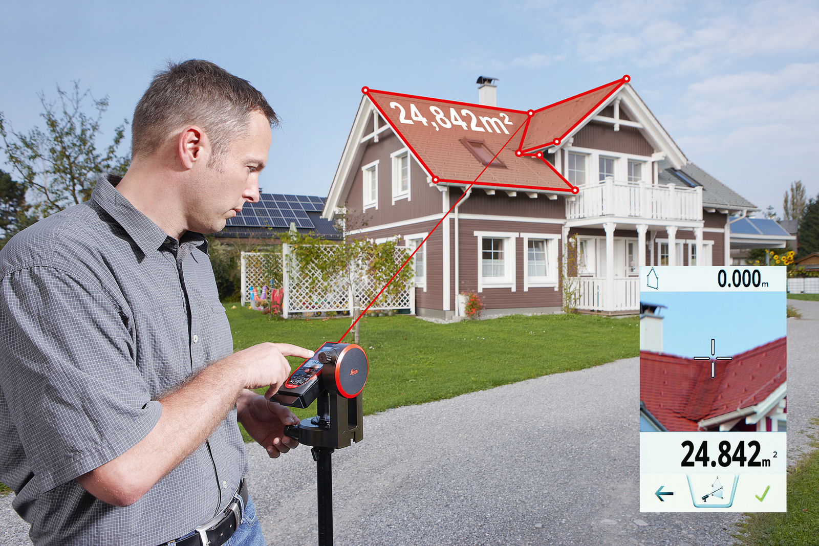
Measure Complex Areas
Data from horizontal, vertical and even inclined areas can be conveniently captured from one location using P2P Technology. Irregular floors, uneven walls, ceilings and sloping roofs can be measured quickly and easily.
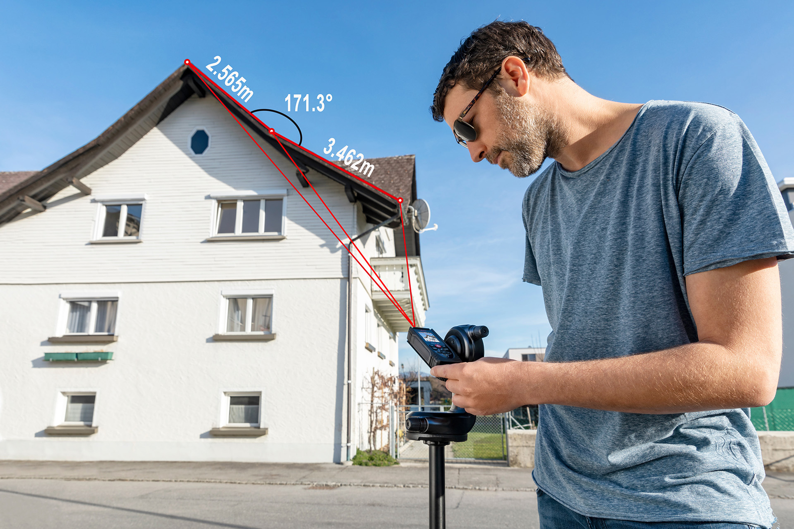
Angle Measurement
An angle defined by three distance measurements, even to inaccessible areas, can be quickly calculated and checked from one location using P2P Technology. The Leica DISTO displays both the angle itself and the lengths of the first and second sections.

ADVANCED FUNCTIONALITY AND VISUALIZATION
With the Leica DISTO Plan App measurement results can be easily documented and visualized. Even the export to any CAD software is possible. In this way, the next steps of a project can be easily planned.

Create Floor Plans and Wall Layouts
The Measure Plan and Measure Facade functions in the DISTO Plan app, combined with P2P Technology, enables the creation of detailed plans and layouts, including doors and windows – even of irregular floors and uneven walls. The 3D measurement points are automatically transferred from the DISTO to the app and processed into 2D plans. This makes it easy to see if any measurement points are missing. The plans can then be exported as CAD data.
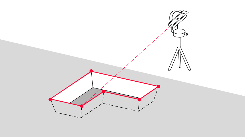
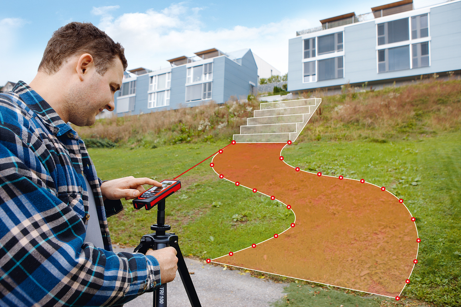
Determine Excavation Easily
The volume of an excavation can be displayed using the Earthworks function in the DISTO Plan app. In combination with P2P Technology this functionality can calculate complex volume measurements using the inclination angle of the slope between the top and bottom of the excavation.
PERFECTLY PREPARED FOR CAD APPLICATIONS
Well-organized DXF data
Measurement data captured with P2P Technology can be stored in DXF format on the DISTO and downloaded via a USB interface for further processing in CAD solutions. The data is available as a floor plan or wall layout (2D DXF files) or as a 3D model (3D DXF files). This simplifies the creation of plans and the quality inspection of objects.
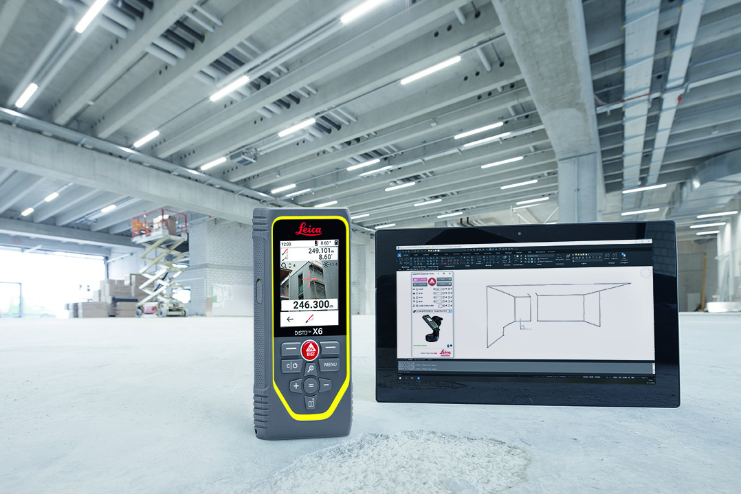
Real-time Data Transfer
Measurement data captured with P2P Technology can be transferred directly on site to a portable device and processed further in any CAD software. This is particularly useful for larger projects as the number of possible captured points is unlimited.

AutoCAD® and BricsCAD®
A plug-in is available in the free software Leica DISTO transfer for the fast transfer of measurement data into AutoCAD® and BricsCAD®.
PRACTICAL EXAMPLES

Measurements for drywall construction: A recommended workflow

Measuring a roof: When safety comes first
WEBINAR AND HOW-TO VIDEOS
Free On-demand Webinar
In this webinar, a range of tasks illustrating the advantages of innovative P2P Technology are presented in detail.


eLearning Center
A collection of how-to videos and tutorials is available in the eLearning Center, showing P2P Technology in different applications and functions.
HOW IT WORKS

Innovative sensors developed by Leica Geosystems provide precise distances as well as angle information. The combination of angle and distance measurement enables coordinates to be captured that define the position of any point. The data can then be processed in any CAD software.
SOLUTION
 |
|
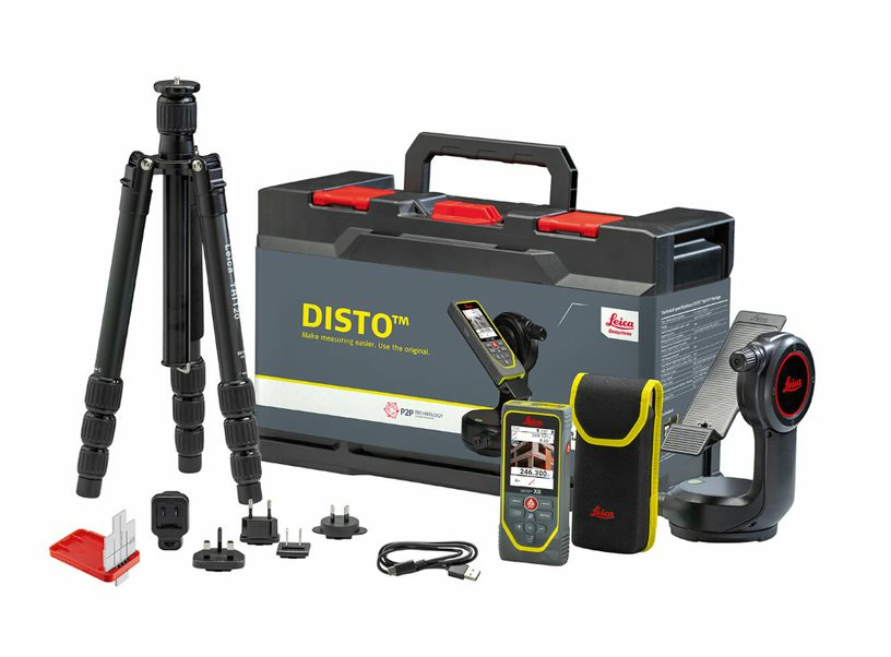
| DISTO X6 P2P Package The P2P solution for outdoor use |
|
| Scope of application | indoor and outdoor |
| Buy Now |