P2P Adapter by Leica Geosystems vs. IMU Technology
In the world of precise measurements, selecting the right technology is crucial. This blog post delves into the comparison between the Point-to-Point (P2P) measuring solution by Leica Geosystems – using an adapter - and the Inertial Measurement Unit (IMU) commonly used in competitor devices which are mostly manufactured in China. Let's explore the benefits and limitations of each technology to help you make an informed decision.
What is P2P Technology?
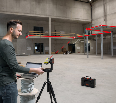
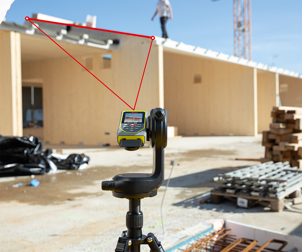
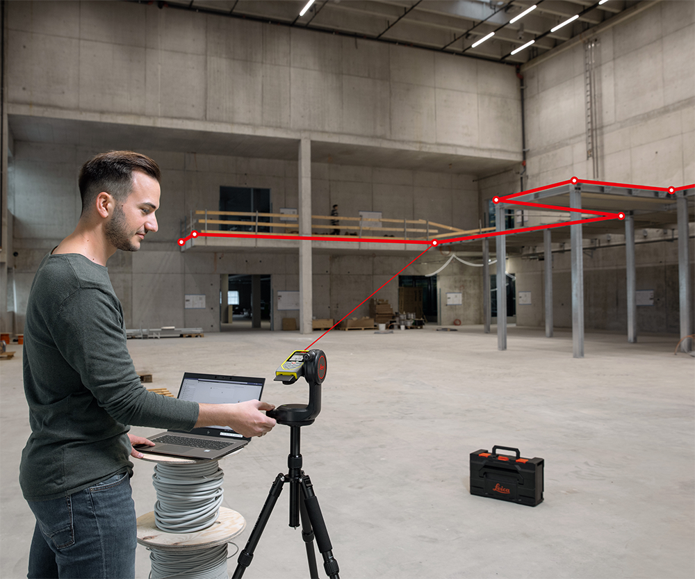
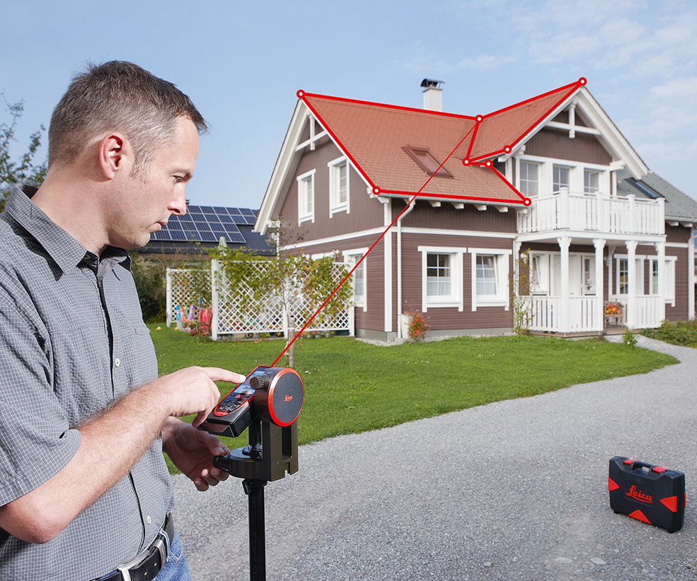
P2P, or Point-to-Point measuring, was defined by Leica Geosystems and first introduced with the Leica DISTO S910 in 2015. This technology allows users to measure any distance between two measured points from any location. Although it is an indirect measuring method, it offers a high level of accuracy.
The Original P2P Technology by Leica Geosystems
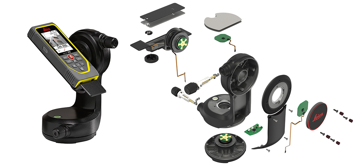
Leica Geosystems uses innovative and well-established Encoder technology for P2P measurements. The static system of encoders ensures a clearly determined accuracy, allowing for a measuring precision of about 5 mm at a 5 m distance. The Leica DST adapter provides fine adjustments for precise aiming, which is essential for reliable results.
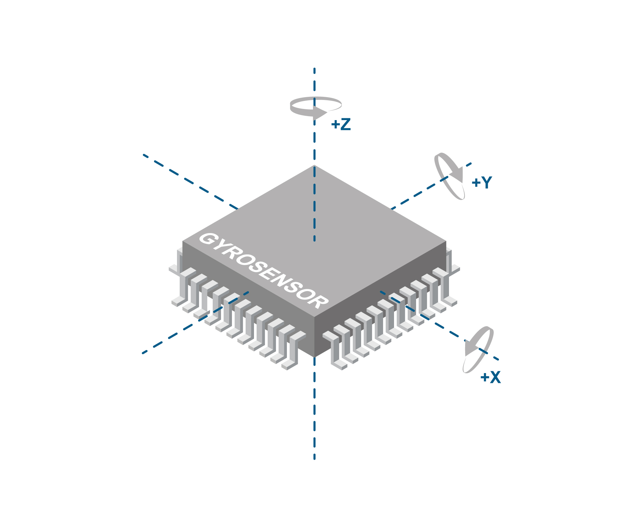
What is an IMU?
An IMU, or Inertial Measurement Unit, is a micro-chip that measures accelerations in all directions. It typically consists of three accelerometers and three gyroscopes mounted at right angles to each other, allowing it to measure acceleration and angular rate in three axes: X, Y, and Z. IMUs are commonly used in various applications, including navigation and control systems. However, they have some limitations, such as sensitivity to environmental factors like temperature changes and magnetic interference, which can affect their accuracy.
Comparing P2P and IMU Measuring Solutions
When comparing the various P2P solutions, it quickly becomes apparent that the IMU sensor is significantly cheaper than a P2P adapter, such as those used by Leica Geosystems. However, there are many reasons why an IMU solution cannot replace such a sophisticated encoder solution in most applications:
- A P2P adapter provides a clearly specified accuracy that can be reliably reproduced in any measuring environment. In contrast, an IMU is affected by environmental factors and may also have issues depending on how the measurement is conducted. While an encoder enables precise aiming over time, slow movement during precise aiming can lead to higher deviations in IMU solutions!
- Precise aiming is essential for accurate P2P measurements, necessitating an adapter with fine adjustment capabilities. Aiming by hand or using a photo tripod only will never achieve the desired precision.
- An IMU only allows measurements between two points and cannot be integrated into workflows required for capturing 2D or 3D plans, as a Leica DISTO can do either directly on the device (such as the DISTO X6) or when used with the DISTO Plan App on a handheld device. Subsequent work on CAD is only possible with a measuring solution equipped with an encoder adapter. Moreover, relocation for capturing CAD data is not feasible with a P2P solution using IMU technology.
- P2P measurements with levelling, P2L (Point to Line) measurements, and Smart Area measurements are all impossible with an IMU solution that only allows measurements between two points.
|
Measure any distance between 2 measurable points Supported by: |
Level the device and Measure any distance between 2 measurable points. Also get the height difference, slop angle, and horizontal distance Supported by: |
Capture geometries like rooms etc. for creating CAD files (directly or via App) Supported by: |
Measure CAD files incl. changing set-up point (relocation) Supported by: |
Measure any distance to a reference line Supported by: |
Measure complex areas in any place like for floorplan, façade, or even inclined roof Supported by: |


Conclusion
Choosing the right measuring solution depends on your specific needs and the level of accuracy required. While P2P measuring with Encoder technology by Leica Geosystems offers high precision and reliability, IMU-based solutions provide a more cost-effective and compact option to get a distance between 2 points. However, the accuracy of IMU-based solutions can be affected by various factors, making them less reliable for precise measurements.