Falk Flöther has been working as a specialist dealer for the CAD software ‘Vectorworks’ since 2006. Initially, he was based in Stuttgart but then, in June 2014, relocated to his own site in the Salzburger Saalachtal valley in Austria. This year he started with the construction of his own company building in Lofer, Austria which includes a training room and a company flat.
In the summer, once the shell of the building was complete and it reached the stage of drywall and façade works, we, Leica Geosystems, contacted Mr. Flöther to talk to him about working together.
We were welcomed with open arms when we approached him as he had already been looking for ways to connect laser measurement instruments and CAD software. Falk Flöther likes to develop entire workflows for his clients' projects to add value, offering an integrated, complete workflow from the initial on-site measurements to the finished plan, including lists or tables of drywall elements. This output could then be used during training courses and product range consultations.
… I don't sell anything before I haven’t tested it myself – and found it to be good!
Falk Flöther says: "It is important for me to know what I am talking about, especially during consultancy work. This and my career path from the construction site to the planning (carpenter, architectural draftsman, state-certified construction technician) makes me want to test the tools used for planning and measuring myself before I recommend them to others.
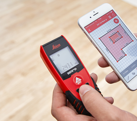
I currently work on a construction site where on-site measurements for drywall installations are required. I do a lot myself and also look after the procurement of the needed materials. A site with so many different surfaces and facing layers requires accurate on-site measurements. Leica Geosystems provided me with the Leica DISTO S910 with the tripod adapter FTA360-S and the tripod TRI70 to carry out my measurements.

My building had lots of slopes, joints and room heights of up to around 7.00 m. My previous experience with measurement devices like this simply doesn’t exist. I studied the basics of surveying back in 2002 as part of my civil engineering training, but only with an analogue, optical level, so, I have a basic understanding of the principles. However, apart from callipers and a distance laser (when measuring as a site manager on a sports hall construction site), I have not touched any digital measuring equipment since. Yet, presumably my CAD expertise, my understanding of geometry and a certain technical affinity worked in my favour.

The workflow:
I was able to work out how to operate the Leica DISTO S910 by myself, without operation instructions, training or videos. It quickly became clear that the "DXF data collection with 3D points" was the option that would be the most useful to me.
Once the device had been positioned centrally in the room, it was aligned horizontally and, as prompted, I rotated it three times by 90° to level it 'mathematically'. Then, with the help of the micro-adjustable stand adapter and Leica DISTO Point to Point function, simply aim at the selected surfaces in the space. Once the last point had been recorded, the 3D points are saved on the device as a DXF file. Pictures of the surveyed points are automatically saved alongside, making it really easy to check the surveyed points at a later date.

Transfer to CAD software:
1. Importing:
Connect the Leica DISTO S910 to the computer and move the DXF file straight into the Vectorworks programme using the "drag & drop" function.

2. Adjusting:
You can adjust the working planes of the imported 3D points with three clicks and then a simple rectangle or polygon can be plotted on the selected surfaces. Advice: different surfaces/panelling can be plotted with different classes of a polygon. (e.g. plot dry construction in green / dry construction in grey)

3. Updating the table.
All I have to do is right click on the table that I have created for the dry construction elements and it updates. With one click I have all the dimensions - and they are always up to date.
The tables I have created are very simple and list all the surfaces in the "dry construction 15mm grey" or the "dry construction 15mm green" class.

All of this works equally well with distance measurement units, for example for corner profiles.
Although the space was geometrically complex, the approach has proven to be so easy and efficient I was also able to use it to measure the shingle facade on the new company building.

The result: a thoroughly recommended workflow.
Summary:
|
Company: Falk Alexander Flöther Challenge
Solution: Precision surveying from one location with the Leica DISTO S910 using the DXF file with 3D points function. |
Results
DISTO S910 product highlights
|