3D Laser Scanning opens the door to new ways to preserve Miami Beach’s Art Deco legacy
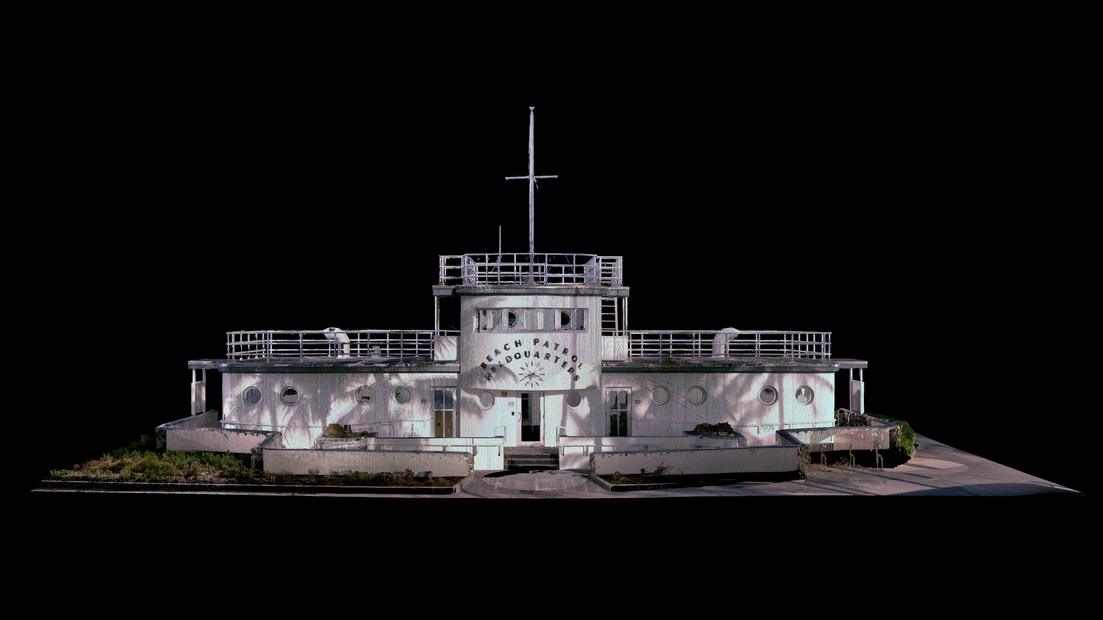
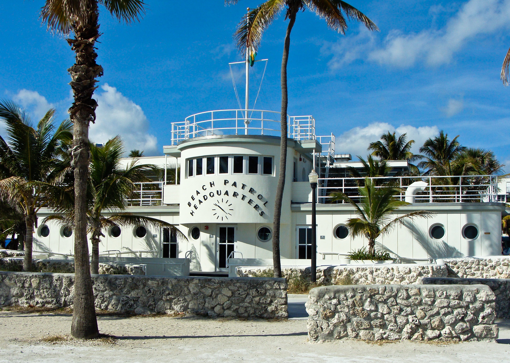
At 1001 Ocean Drive in Miami Beach, tucked away from the bustle of the street and facing a broad expanse of white sand and shaggy dune grass, sits a small building that looks more than a little like a luxury liner of yore.
A stout one-and-a-half story structure of elegant curves and pert porthole windows, the 1939-built “Beach Patrol Headquarters” is a pearl of the city’s Art Deco district and the current headquarters of its Ocean Rescue team.
So when reality capture professional Corey Weiner went looking for striking places to scan with the new Leica BLK360, Miami Design Preservation League (MDPL) Executive Director Daniel Ciraldo knew right where to send him.
“Here we had this amazing lifeguard structure that was built at the height of the Art Deco movement and beautifully restored,” said Ciraldo, whose organization fights for the preservation of Miami’s Art Deco treasures and shares an address with the Beach Patrol building.
This year, the city completed construction of a seven-mile long beach walk from its northern limits to the southern tip of South Beach, making the Beach Patrol building an even more prominent landmark and one he said was essential to preserve Miami Beach’s past and future.
“It's connected to memories. People remember going to the beach and seeing the building [and watching it change], so it is interesting to have a sense of time and continuity, to understand how these buildings evolve, how their site evolves, how the neighborhoods evolve,” Ciraldo told Leica Geosystems. “But this is probably one of our most iconic Art Deco buildings. And so that's why we thought this would be a great one to have fully scanned.”
Scanning the site
The Beach Patrol building, in addition to being the operational headquarters for Ocean Rescue, also features public bathrooms and showers for beachgoers. That posed particular challenges when it came to scanning the site and keeping people out of each setup, and made the new BLK360, with its higher definition imagery and speedy scan times, the perfect tool for the job.
“As I'm scanning, people are coming in and out all day long, cars are going in, and the side is beach access for utility trucks—a ton of activity,” said Corey Weiner, principal and founder of c2a.studio, an on-site as-built laser scanning service for architects, interior designers, builders, and engineers.
That level of activity would have made using the BLK360 G1 more tricky; with the new unit, the experience was a breeze.
“With the old unit, I would have to take a three-minute bet on the public restroom entrance being free, which is just not as safe as a 40-second one [with the new unit],” he explained. “It probably took an hour to scan the site because of the public, but if, let's say, it was abandoned – if it were just me there – I probably would have gotten the whole thing done in 15 minutes.”
Preservation for the ages
But beyond capturing a single historic structure, the resulting digital twins of buildings to millimeter accuracy has profound implications for the future of historic preservation beyond traditional surveying methods – methods that were core to MDPL’s founding mission, Ciraldo said.
“Probably our biggest claim to fame happened in 1979 when our membership took it upon themselves to survey the Art Deco district, and we succeeded in getting it listed on the National Register of Historic Places, which at the time was the first 20th-century district to be protected or to be listed under the National Register. So surveying, it's in our DNA,” he said. “But it's really cool to see how surveying has developed over time because, in our archives, we have the original survey from 1979 where essentially, people are going one by one and describing the building in writing, on a piece of paper, and then taking individual photographs.”
Ciraldo said he was impressed by what could be done with the BLK360 and what it meant for the Beach Patrol Headquarters as well as other sites in the area.
“With this Leica Geosystems technology, we can capture the building as it currently is, which has many uses in the future, whether for future renovation and restoration projects, but also given that this building is right on the beach, which faces the impacts of hurricanes, storms, and even climate change,” he explained. “We think it's more important than ever to have real, comprehensive, and detailed surveys of these buildings, to have that record of how they look now, which can help guide our work going forward.”
“It’s really the next era of preservation, you know?” he added. “I only wish we had it in the 1930s and 40s.”