RTC
RTC
 BLK360
 BLK360 SE
 BLK2GO
 BLK ARC
 BLK2FLY
 BLK3D
BLK3D
 Accessories

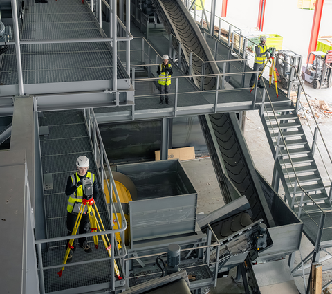
The new Leica RTC series brings one trusted design across three performance levels - Leica RTC300, Leica RTC500, and Leica RTC700 - built for a faster, more connected way of working in reality capture.
In this expert insight, Andrea Biasion, Program Director of the Terrestrial Laser Scanning portfolio and Team Lead of the new RTC series of laser scanners, shares why this launch matters now and how the RTC series helps teams capture, connect, and collaborate as work unfolds.
There are two main pillars of any laser scanning job: The first is efficiency, or how fast and right something can get done; the second is confidence you can prove with precise, accurate data that is ready to be worked on. We built the RTC300, RTC500, and RTC700 with those twin ideals in mind, enabling faster data capture through upgraded hardware and software intelligence so users spend less time in the field and are confident in their data and deliverables.
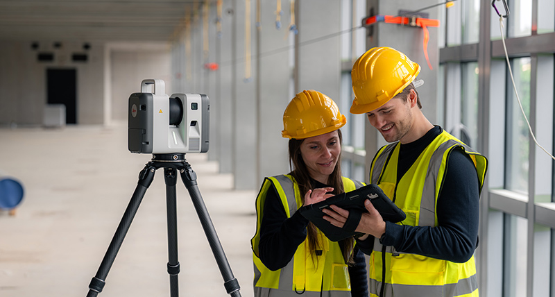
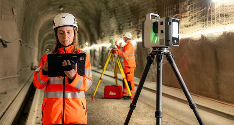
What does that mean? On the hardware side, it means we continue to advance. With the RTC300, RTC500, and RTC700, users can expect up to 35 per cent faster data capture than other laser scanners on the market. And on the software side, scan data can now be viewed by the entire team in the field and in the office while you scan, giving you a head start on verification and ensuring you never have to return to the field to capture data you missed the first time. In industries like construction, plant, and public safety, reducing time on site reduces exposure and increases throughput.
The result is confidence at pace: real-time awareness for every stakeholder, smoother coordination between field and office, and deliverables that stay on track. Put it all together, and we like to call it workflow intelligence – our new dimension in reality capture.
Workflow intelligence across field, cloud, and office
But let’s dive a little deeper. For most 3D laser scanning projects, the workflow is still sequential: capture in the field, bring data back to the office, register, then share for production. Each stage waits for the previous one to finish and timelines stretch because the pipeline is linear.
With the new RTC series, that gap starts to close. Using Livelink in Leica Cyclone FIELD 360, preview data is uploaded to Hexagon GeoCloud, where teams can connect field crews and office experts into a single live project environment while data capture is still underway.
By centralising all this data in one unified source, projects are transformed. A senior scanning expert can act as a coordinator, monitoring incoming data, supporting registration, and guiding quality checks, while operators focus on capture, making larger, mixed-ability teams easier to run efficiently.
And while the full data is stored on the device, it’s simple to also upload the final dataset into GeoCloud from Cyclone FIELD 360 or Leica Cyclone REGISTER 360 PLUS. That means that all the information in scan data like GeoTags, measurements, tagged notes, documents, and embedded images, is now in the hands of every team member. What was stored locally on a computer or on large hard drives is now easily available to everyone who needs access to the project.
A new dimension in reality capture
With this new RTC series, we wanted to push a collaborative, connected laser scanning solution that delivers on accuracy, speed, and user confidence. Our goal was to set these laser scanners apart from previous iterations and competitors, and to address issues in end-to-end customer workflows – primarily by reducing the time between data collection and delivery to our users' customers.
We’ve positioned this new line of RTCs as the solution to pair with users’ workflow needs. From advanced work Leica Cyclone 3D to connections with popular third-party CAD and BIM workflows via Leica CloudWorx, users can customise which software application best suits their RTC.
By choosing an RTC300, RTC500, or RTC700, users join this journey with Leica Geosystems of transforming the way we work with scan data. We firmly believe that real-time interconnectivity between field and office, real-time interconnectivity between field users, and remote project coordination might sound revolutionary today, but will soon become the norm.
The climate today in reality capture is constantly moving; it’s fast, with little time for error or delay. The RTC300, RTC500, and RTC700 capabilities, along with their intelligent workflows, address the industry constraints our users face. Under strong time pressure, strong cost pressure, and customer demand for quick delivery of data with the highest quality and accuracy. With the collaborative workflows of the RTCs, users will experience a workflow that not only addresses their pain points but solves them.
Learn more about the Leica RTC Series and Livelink capability in Leica Cyclone FIELD 360.

Andrea Biasion
Program Director TLS