 RTC
RTC
 BLK360
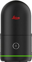
 BLK2GO
 BLK ARC
 BLK2FLY
 BLK3D
BLK3D
 Accessories
Leica Geosystems award-winning reality capture technology.
Explore laser scanning solutions designed to move you from capture to deliverable with speed, precision, and flexibility.
Laser scanning solutions for all applications.
Static laser scanners
RTC
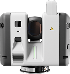
Advanced, high-detail capture
Fast, high-accuracy tripod scanning for large, complex jobs where collaboration is key.
BLK360
Accurate interior documentation
Fast tripod-based capture for room-scale documentation and high-confidence scans.
Compare static laser scanners
Mobile laser scanners
BLK2FLY
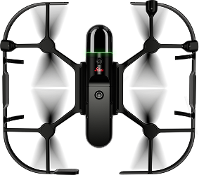
Exterior and hard-to-reach capture
Autonomous aerial scanning for exteriors, elevations, and inaccessible areas.
BLK2GO

Walk-through capture
Capture as you move through buildings where coverage speed matters more than stationary setups.
BLK ARC

Mobile and robotic repeatability
A flexible mobile laser scanning platform built for robots, backpacks, and manual carriers.
BLK3D
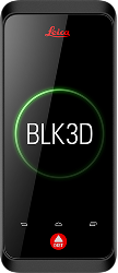
Document and measure from images
A handheld tool for measurable photographic documentation.
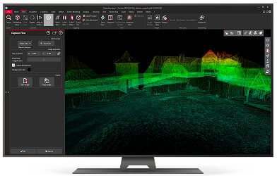
Supported software integrations.
![]()
Leica's accurate and easy-to-use laser scanning devices are currently allowing us to offer more reliable and accurate property measurements to our customers.
James Hennessey
Head of Computer Vision, Pupil
Built for the way teams capture reality.
From surveying and construction to manufacturing and preservation, discover how teams around the globe are leveraging Leica Geosystems Reality Capture technology to capture the world around us.
Expert advice.
Proven solutions.
Not sure which solution is right for your business? We are here to help make the decision easier. Connect with one of our specialists and we will work with you to find the right fit.