 RTC
RTC
 BLK360
 BLK2GO
 BLK ARC
 BLK2FLY
 BLK3D
BLK3D
 Accessori

Laser scanning is dominated by two basic scanner technologies: Static laser scanning such as traditional terrestrial laser scanners versus SLAM-based mobile scanners. Viewing these technologies not as competitors, but as complementary tools, is the key to building a more versatile and effective reality capture process. This guide will explore the case for each methodology to help you design the perfect workflow for any challenge.
The Case for Static Laser Scanning: The Standard for High-Fidelity Data
When a project’s success hinges on the highest degree of accuracy and detail, static laser scanning remains the definitive standard. For applications like structural analysis, heritage preservation, or industrial fabrication, every measurement must be verifiable.
Static laser scanning is built on a cornerstone of planning and precision. By capturing data from a series of deliberate, fixed positions, it produces a dataset of unparalleled accuracy and density—a "digital bedrock" that provides absolute confidence for the most critical decisions. It is the trusted foundation upon which many successful reality capture businesses are built.
Professionals who require this level of verifiable data rely on instruments like the quick and compact Leica BLK360, and the high-speed, high-accuracy Leica RTC360, both engineered to deliver the high-fidelity results that these demanding projects require.
The Case for SLAM-based Scanning: Redefining Speed and Scale
As project scopes grow and timelines shrink, the ability to capture comprehensive data quickly becomes a crucial advantage. Mobile mapping, powered by SLAM (Simultaneous Localization and Mapping) technology, is the workflow designed to meet this challenge head-on.
This methodology is about continuous, on-the-move capture. It empowers professionals to document vast and complex environments in a fraction of the time required by traditional methods.
The real-world impact of this speed is staggering. As José Ruiviejo, CEO of the Spanish GIS development firm Fisotec, explains:
"Typically, we can scan a 40,000 square meter warehouse in a day with the BLK2GO and process the data in an hour and a half."
This level of efficiency redefines what's possible on a project timeline. This dynamic workflow is made possible by handheld scanners like the Leica BLK2GO, and the philosophy also extends into autonomous solutions like the Leica BLK ARC and Leica BLK2FLY.
How a Versatile Toolkit Reshapes Business
Integrating SLAM-based LiDAR scanners into your services does more than just accelerate existing tasks; it can fundamentally reshape the business landscape. Their intuitive nature empowers more team members to contribute, freeing up senior experts for processing, high-value analysis and client strategy.
This newfound efficiency also unlocks new revenue streams. Services that were once cost-prohibitive, such as weekly construction progress scans or creating digital twins for facilities management, become viable and profitable. Adding a rapid capture capability to your toolkit is about creating new opportunities for growth.
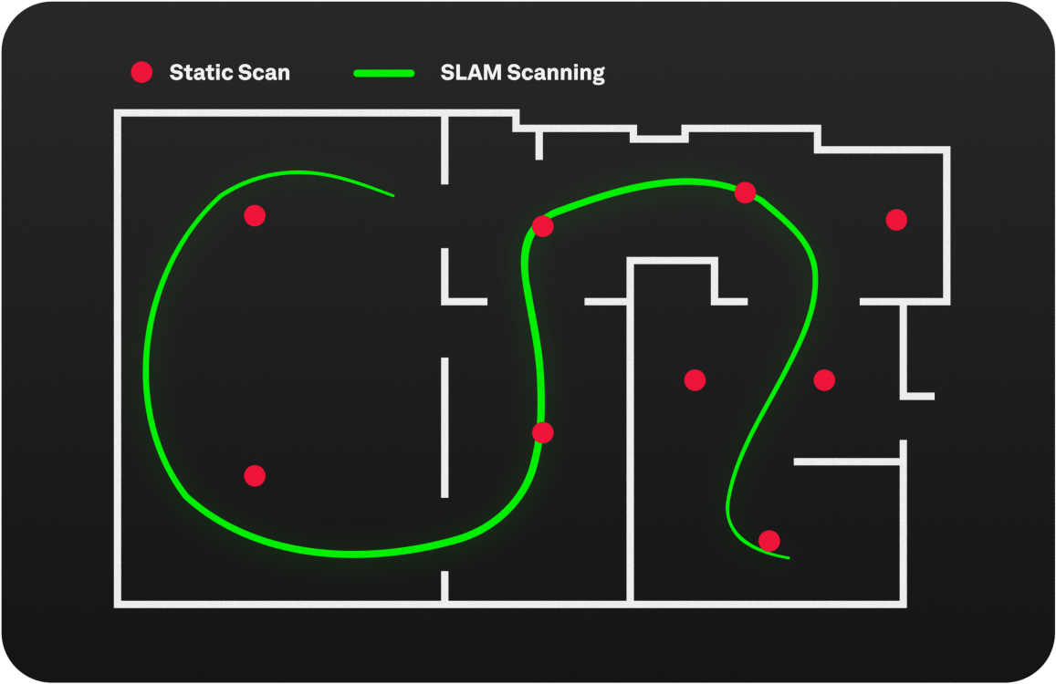
When Static and SLAM Converge
The most sophisticated reality capture strategy is often a hybrid one, synthesizing the strengths of both workflows. Here, “either/or" becomes "yes, and." It’s an approach where a unified team has the versatility to deploy the right tool, or combination of tools, for any task.
Consider a large commercial building project. A team might first use a mobile scanner to rapidly map the entire interior, establishing a complete as-built context in hours. With this comprehensive map as a guide, they can then deploy a static scanner with surgical precision, capturing survey-grade detail in only the most critical areas—the primary MEP room, the elevator shafts, and key structural tie-in points.
This seamless fusion is made possible by a unified software ecosystem. Software like Leica Cyclone REGISTER 360 PLUS or PinPoint serves as the essential bridge, allowing the agile data from a BLK2GO and the high-fidelity data from a BLK360 to be cleaned, processed, and merged into a single, cohesive, and more valuable point cloud that can be exported into a variety of popular file types for further modeling and analysis.
From a Simple Choice to a Complete Strategy
The conversation around Static vs. SLAM has evolved. The most effective answer is rarely one over the other. It's a richer, more strategic discussion about building the right capabilities for the challenges ahead.
The modern reality capture professional is a strategist whose value lies in the ability to analyze a project’s unique needs and design the perfect workflow. Your success is amplified when you have a complete, integrated platform—both hardware and software—that allows you to execute any strategy without compromise.


