
An argument could be made that civilization is only as good as its sanitation.
From ancient Babylonia to modern-day Berlin, how we move water and waste has been a critical hallmark of modernity, giving rise to cities as we know them.
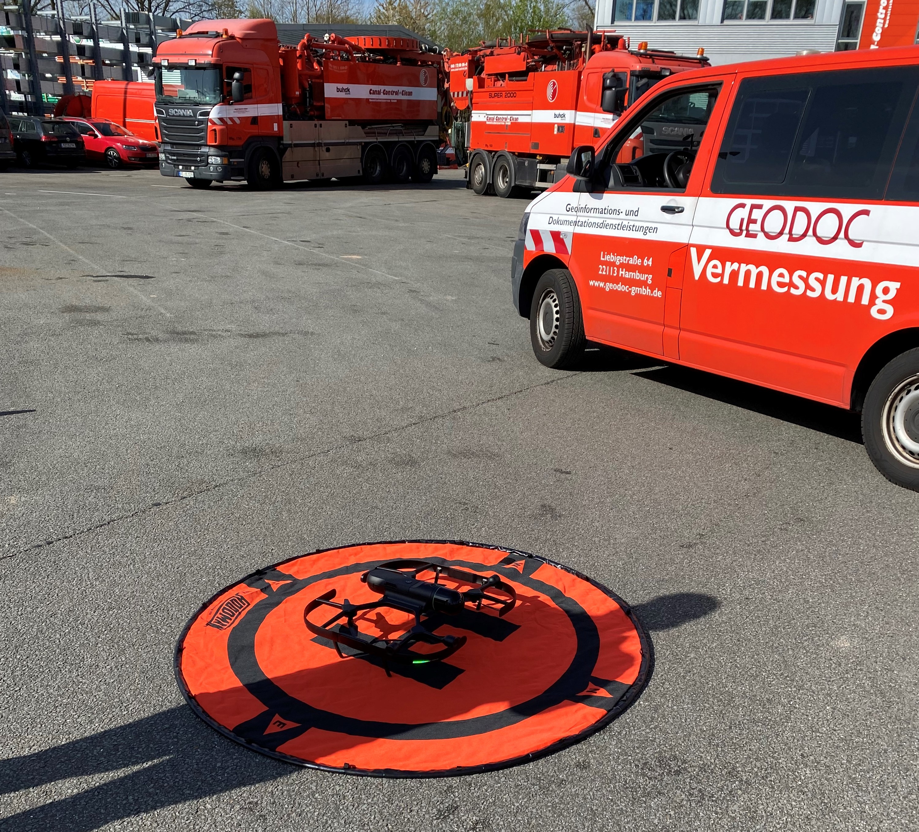
But 21st-century cities require 21st-century solutions to maintain their sewers and waterways, which is where German drainage, sewer, and surveying company GEODOC comes in, combining documentation and surveying methods using the Leica BLK2FLY and Leica RTC360 to tackle its most complex projects.
“We often have questions about very exact measurements inside the sewer and underground structures for rehabilitation and maintenance, and therefore, it's very important to get this level of accuracy,” said Lüdeke Graßhoff, Managing Director of GEODOC Geoinformation and documentation services.
GEODOC began using the RTC360 terrestrial laser scanner for precision jobs and added a BLK2FLY flying laser scanner in 2022 to tackle particularly challenging spaces.
That technology, Graßhoff said, has significantly expanded their customer base and the types of projects GeoDoc can take on, including tunnels in Hamburg, scans for roof construction projects for private customers and architects, flood protection buildings (Hamburg has more than 100 km of flood dikes) and more.
“We now get very interesting and special jobs with this equipment,” he continued. “We are working all over Germany now — Hamburg is in the very northern part of Germany, and we are traveling now to Munich in the south and all over with these scanners.”
An “unsolvable” problem remedied with the BLK2FLY
Adding the power of Leica Geosystems laser scanners has enabled GEODOC to help customers and municipalities solve some previously unsolvable problems of survey and documentation in difficult-to-reach areas that suffered environmental and other damage.
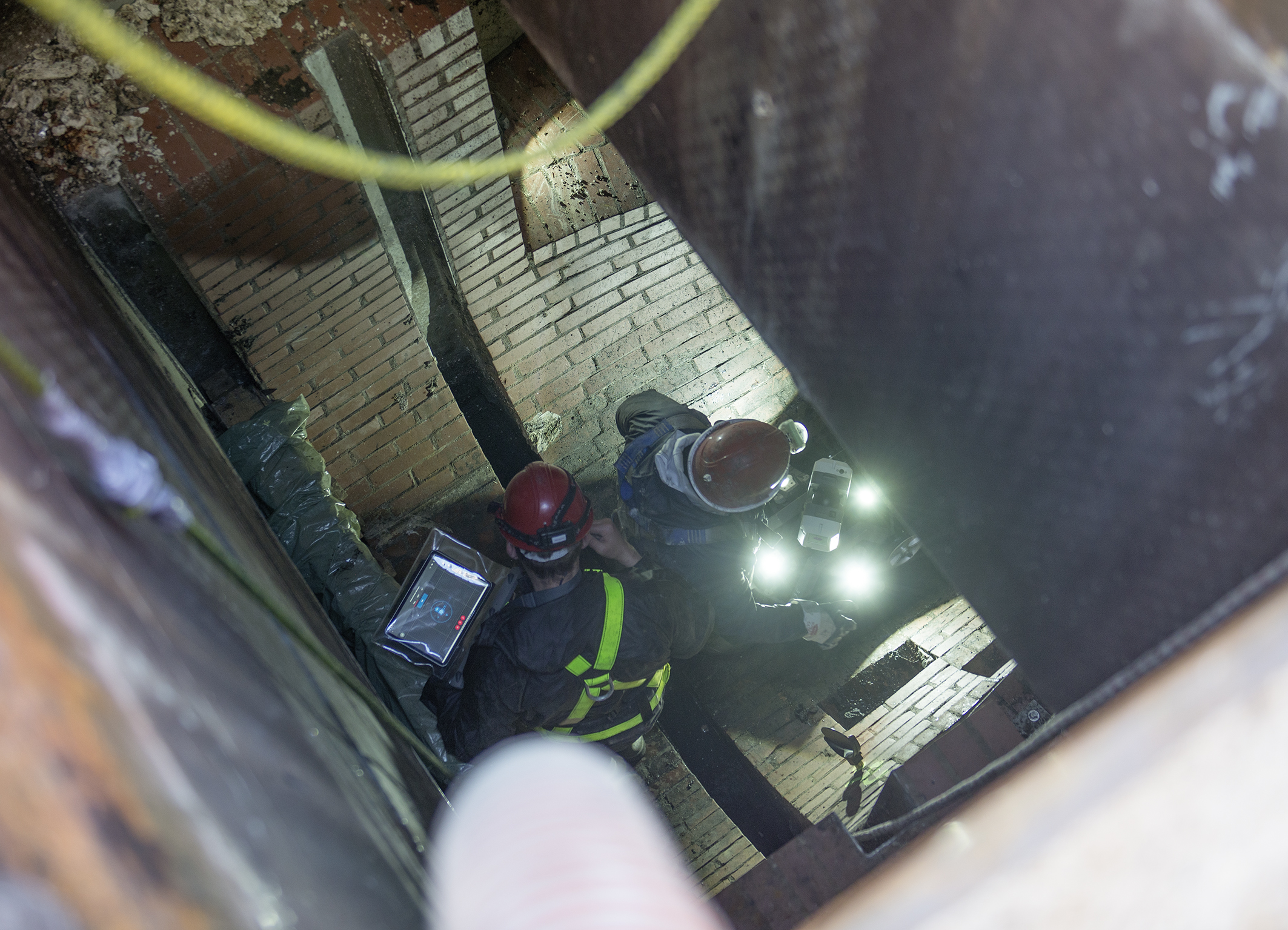
“In Glauchau in Saxony, there was a sewer system which started in a garden of a house and then went into a hill,” Graßhoff explained. “About 75 meters in, there was an obstacle in the sewer, so the sewer inspection camera couldn’t go on. The sewer was egg-shaped and in terrible condition so that nothing could go through it.”
“The municipality tried to inspect the sewer also with a UAV, but also wasn’t possible to get forward,” he continued. “From the other side, it wasn’t possible to reach the damaged position either.”
An accurate scan was required because a new manhole had to be built to rehabilitate and repair the pipe, and the project couldn’t go forward without one.
“When you dig to a depth of 17 meters, everything has to be very accurate,” Graßhoff said.
That’s where the BLK2FLY and RTC360 came in.
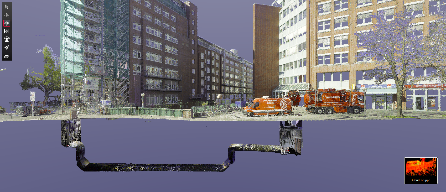
The GEODOC team was able to scan the pipe with the RTC360, putting it on a CCTV-camera tractor system as deep into the tunnel as it would go. Next, they had the BLK2FLY map the complete terrain (about 10.000m² in one hour), georeferencing everything with targets.
“Afterward, we combined RTC360 scan and BLK2FLY scans [into Leica Cyclone REGISTER 360 PLUS] so we could define the exact position of the sewer system,” he said. “As you can imagine, when you stand at the starting manhole and look onto the hill, you have no chance for orientation.”
From there, they exported the cleaned and completed project into an LGS file delivered with Leica TruView, enabling the customer to review the data in all facets without needing any additional software solutions.
“This is a great advantage [of Leica Geosystems reality capture software workflow], that you can import into one project from different scanning sources,” Graßhoff noted.
After this, the team then brings the LGS into Leica Cyclone 3DR for analysis and Leica CloudWorx for BricsCAD when drawings and other deliverables are required.
In this way, GEODOC was able to use Leica Geosystems scanning and software solutions to do what traditional documentation could not and allow the reconstruction project to proceed.
Tackling a massive modern power plant project
GEODOC’s success with these scanners helped land them the job of scanning a coastal power station in the city of Kiel, working with the municipal utility to get complete documentation of the power building for a repair and reconstruction project. That included a long run of piping that would bring seawater in and out of the power station and a nerve-wracking flight with the BLK2FLY — for the operator, at least.
“Our only chance was to scan it from the air and the view of the seaside,” Graßhoff explained. “Therefore, I had to fly with the BLK2FLY above the Baltic Sea. Because it was my first official project with the BLK2FLY, I was really afraid and stressed! The flight had to be done manually, and the sensors weren’t made for scanning over the sea.
The flight went off without a hitch, Graßhoff gracefully piloting the flying laser scanner and completing the scanning project in a way only the BLK2FLY could.
That said, he isn’t planning on making over-water scans a regular part of his operations.
“I was very happy when the BLK2FLY and I had normal ground under us again,” he told Leica Geosystems.
Still, Graßhoff was pleased that GEODOC could participate in the further development of the platform, which is the most modern gas power station in Europe and is currently in the process of becoming climate neutral by 2035 and converting to hydrogen operation.
”It’s so important because of the huge use of renewable energy sources,” Graßhoff enthused. “The power station can be booted from 0 to 180 MWatt in 5 minutes.”
Using the RTC360 for high-detail scans of the building and BLK2FLY for difficult-to-reach areas, GEODOC was able to give the coastal power station authority the documentation they needed in a timely fashion.
“The ability to merge the data from the different scanners is really perfect,” he added. “We can even combine static scan data (RTC360) with mobile mapping data. So, we as users have the chance to combine everything and use the best tools for the different use cases and requests.”
