
For Fisotec, a Spanish company with more than 15 years in developing Geographic Information Systems (GIS) and creating asset inventory for smart cities, there was no challenge they weren’t prepared to overcome.
But being asked to laser scan a building that was essentially a hall of mirrors threw them a curveball.
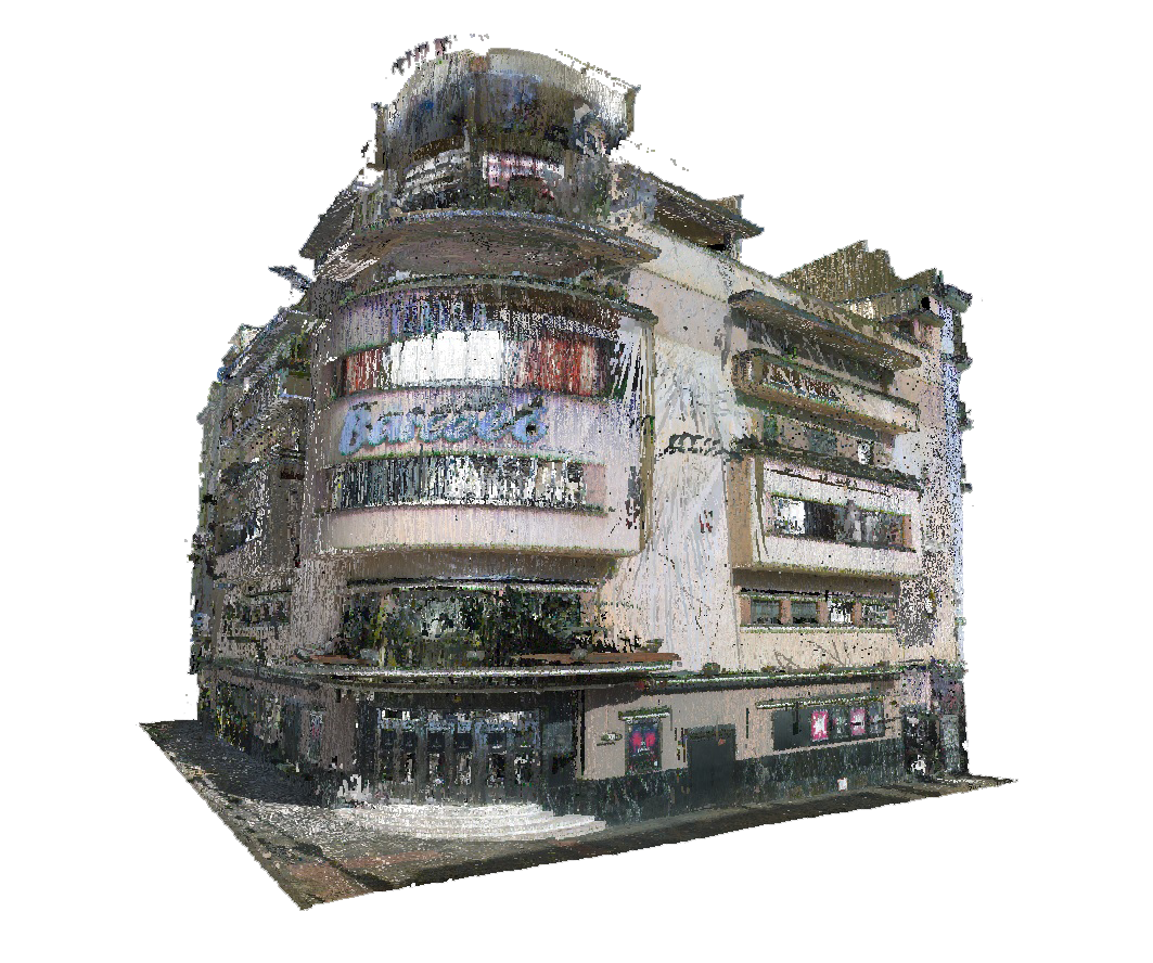
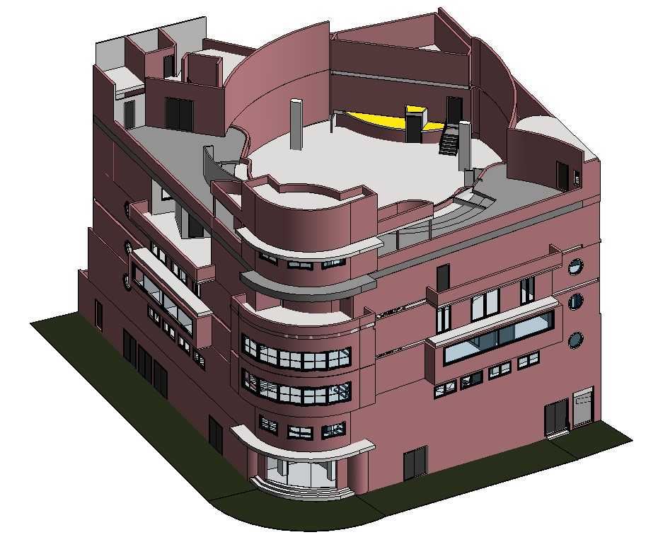
The Barcelo Theater was the most famous discotheque in Madrid – at one point the city’s equivalent of Studio 54 in New York City — with long swooping Art Deco curves that reflect its 1930s lineage. Inside, it features many nooks and crannies, as well as floor-to-ceiling mirrors amid the dance hall on the first floor, built to catch the flashing lights, glitz, and glamor of the 1980s. It’s an icon, a landmark, and a genuinely tricky place to create an accurate 3D model of, which the theater needed in order to be listed as an Asset of Cultural Interest, a special designation within the Spanish government that acknowledges and protects the historical value of the property and puts it, to some degree, in the public domain.
“Laser scanners and mirrors do not get along well,” said José Ruiviejo, Fisotec’s CEO. “The mirrors reflect the lasers and you end with duplicate data due to the reflection.”
Knowing they needed a BIM model where none existed, the Barcelo Theater contracted with Fisotec — and its array of Leica Geosystems 3D laser scanners — to get the job done.
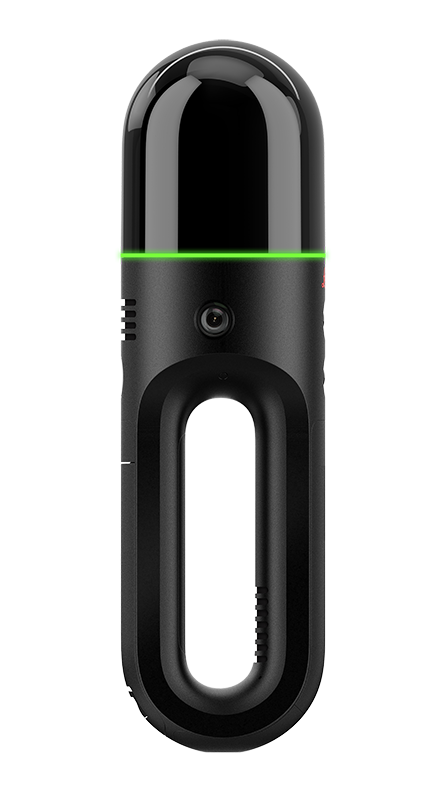
The team quickly developed a plan to tackle the difficult architecture using the Leica BLK2GO handheld imaging laser scanner as their primary tool.
“Keep in mind that it was not possible to cover the mirrors,” Ruiviejo said. “We learned the importance of planning before scanning, evaluating the building first, evaluating the structure and the path, and preparing our scanning process to follow.”
But with careful planning, they came up with an ingenious solution.
“We divided the space in an imaginary grid, and we captured the data several times, then at the office we worked on the software following the same principle to clean the data to reduce the noise and improve the quality,” he continued. “To support our workflow, we also took several pictures with the device.”
The building scan took 2.5 days, plus another few days for processing using Leica Cyclone REGISTER 360 PLUS BLK Edition and a couple more weeks to create a complete BIM model.
That’s not usual for the speedy BLK2GO, they said, but the difficulty of the mirrored level meant capturing as much extra coverage as possible for post-processing later.
Typically, we can scan a 40,000 square meter warehouse in a day with the BLK2GO and process the data in an hour and a half,” Ruiviejo said.
Still, they said the device was indispensable to the project.
“Despite being one of the most complex projects that we have done so far, the BLK2GO made it easy because it is easy to capture the data while you visualize your path,” said Fernando Cobo, GIS specialist at Fisotec.
“The experience was something that we will never forget,” Ruiviejo told Leica Geosystems. “But also, our team learned from the building size, especially how to prepare the scanning for this type of construction. Now we are going to start a big project with 26 buildings, and all these lessons learned will be put into practice.”

Adding Reality Cloud Studio to the mix
Fisotec is no stranger to Leica Geosystems technology, having used the Leica BLK360 G1, Pegasus TRK 700 EVO, and Leica RTC360 on various projects. This was their first major project with the BLK2GO, and when given the opportunity to try Reality Cloud Studio alongside it, they jumped at the chance.
“I fell in love with the BLK2GO as soon as we began the proof of concepts,” Cobo said. “With Reality Cloud Studio, we had a couple of weeks using it; the results are amazing – especially if you want to impress your customers.”
Cobo pointed out the auto-meshing, cleaning, and moving object features of the cloud application as particularly helpful.
“We are still learning all the capabilities, but so far, the auto-mesh is great and easy to generate,” he told Leica Geosystems. “One of the things that is really impressive is the reduction of noise, considering that with a handheld device like the BLK2GO, it is always present.”
He also noted that field-to-cloud uploading helps them not only begin visualizing the data sooner, increasing efficiency but also is handy for being able to show customers their work faster than they would be able to otherwise.
Most recently, they’ve used Reality Cloud Studio to showcase their scans of an industrial park dedicated to logistics, a wastewater treatment plant in Valencia, and the Church of Santa Maria la Mayor in Alcaudete.
“All the clients are very satisfied,” Ruiviejo said.
Having overcome the complexities of the Barcelo Theater, the Fisotec team looks ahead to the next challenge.
“Each scanning project has their own particularities, from castles, singular buildings to bus stations,” Cobo said. “Scanning is never boring.”


