 RTC
RTC
 BLK360
 BLK360 SE
 BLK2GO
 BLK ARC
 BLK2FLY
 BLK3D
BLK3D
 Accessories
Image
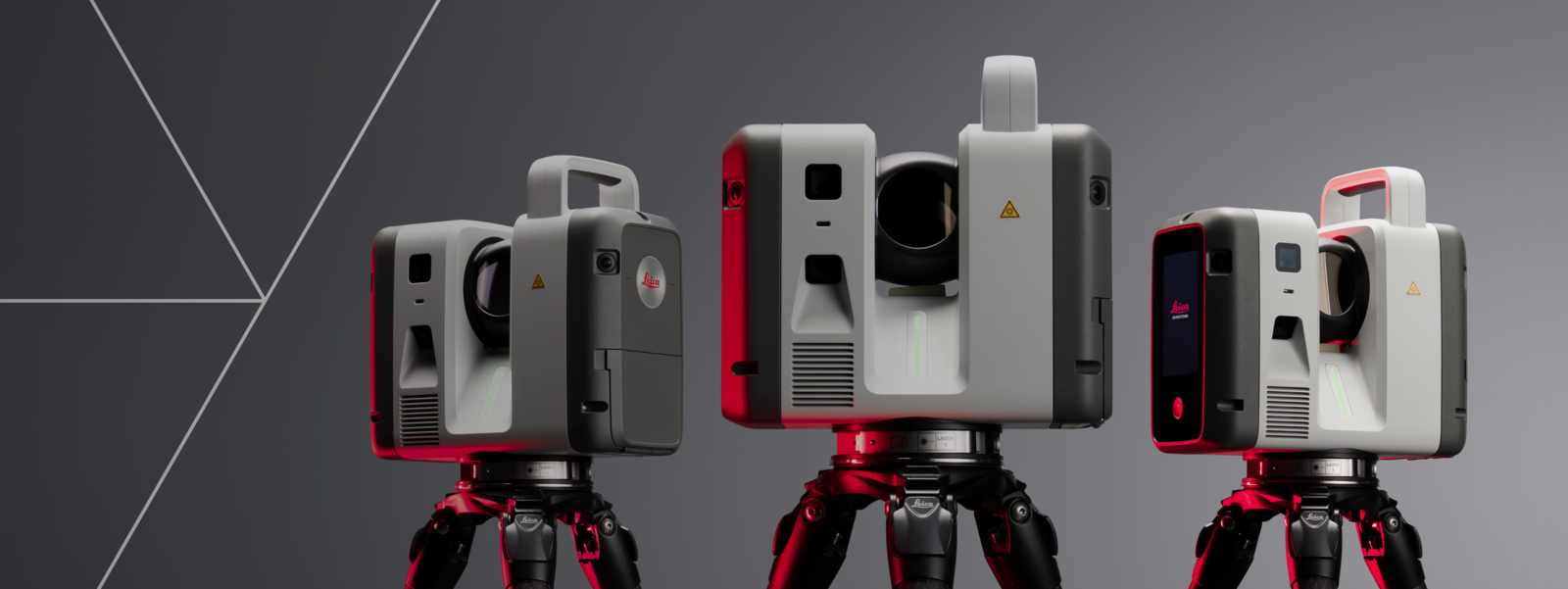
The Leica RTC series
Advanced laser scanning. Real-time intelligence. Your work, made faster than ever.
What makes the new RTC Series different.
![]()
Higher performance scanning
The latest RTC hardware combines high-speed, high-density laser scanning and onboard storage with a more rugged IP55-rated design to handle the most dynamic job sites.
![]()
Field-to-office collaboration
Livelink in Leica Cyclone FIELD 360 eliminates site revisits while work is still unfolding by connecting field and office teams through Hexagon GeoCloud.
![]()
Faster data visualisation
VIS technology automatically registers scans in the field, turning captured reality into full, usable datasets — ready for BIM, CAD, and the visualisation tools you already use.
![]()
Built for the way you already work
RTC fits the software ecosystem your teams use today — connect to Hexagon GeoCloud, Cyclone, Autodesk Revit, and other CAD/BIM tools without switching workflows.
See the new Leica RTC in action.
One trusted design.
Three levels of performance.
Choose the Leica RTC scanner that fits your project scale, working conditions, and performance requirements.
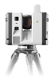
Leica RTC500
High-performance scanning with operational flexibility.
Leica RTC700
Maximum range and accuracy for the most demanding work.
From field capture to final deliverable, without fragmentation.
![]()
Capture
Superior scanning performance, built for real-world demands.
Start with trusted Leica RTC scanning performance in the field. Engineered for speed, precision, range, and robustness, our new RTC Series helps teams capture high-density 3D data across demanding environments with VIS auto-registration and reliability professionals expect when it has to be right.
![]()
Collaborate
Bring field data into a connected project environment.
Move beyond isolated field capture. Activate Livelink in Leica Cyclone FIELD 360 to initiate a real-time collaborative project with colleagues on site and in the office through Hexagon GeoCloud. Teams can coordinate while data is being captured, helping support earlier quality checks, progress monitoring, and decision-making.
![]()
Deliver
From storage to analysis to streaming, work the way you already do.
Work with RTC data across our software ecosystem. From storing, sharing, visualising, and analysing through Hexagon GeoCloud, to deeper analysis in Leica Cyclone 3DR and the ability to stream data to Autodesk Revit and other popular CAD and BIM software, we have a way to work for nearly every workflow.
The proof is in the data.
Check out the latest advancements in our data quality and visualisation.
Built for specialised reality capture workflows.
Leica RTC supports professionals across industries where accurate, connected 3D data helps teams make better decisions faster.
Image

Surveying
Capture accurate site conditions, manage large scan volumes, and coordinate complex projects with confidence from field to office. Bring registered scan data into BIM workflows, so VDC teams can model against real conditions with less friction.
Image

Building construction
Document existing conditions, verify progress, support Scan vs BIM workflows, and reduce the risk of decisions based on incomplete site information.
Image

Plant and industrial
Capture complex facilities where accuracy, access time, and coordination matter. Support safer planning, better documentation, and more confident engineering decisions.
Image

Public safety and forensics
Capture scenes quickly and accurately, preserve critical details, and support investigation workflows with reliable 3D documentation.
Image

Infrastructure
Document roads, bridges, tunnels, rail environments, and large-scale assets with performance built for demanding project conditions.
Get the edge on the competition with Leica RTC's industry-leading hardware and software workflows.
Talk to an expert to find the right Leica RTC for your work.