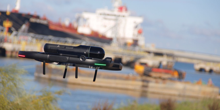
When global energy company Cepsa, needed to plan a new pipeline at its La Rábida Energy Park, based in Andalusia, Spain, they knew that using traditional surveying techniques to map their current facility would be costly, time-consuming, and complicated.
But the company’s dedication to forward-looking technologies and sustainability (part of its “Positive Motion” strategy) gave them the idea to try something different, using Leica’s BLK2FLY flying imaging laser scanner to scan the area in a fraction of the time.
The project scope was two-fold. The first was to create a digital terrain model (DTM) of the area where the expansion is planned, getting precise measurements of existing racks and piping, as well as other existing structures that needed to be accounted for and to plot out the design and course of the new pipeline safely and efficiently.
The second was to see if BLK2FLY would be an ongoing, instrumental part of Cepsa’s future engineering planning.
On the first point, the BLK2FLY passed with flying colors.
“The cost and time savings were huge,” said Patricia Chacón, Cepsa’s Piping Manager. “Moreover, a static scanner project for the same area would take no less than five times as long, and we wouldn’t get the aerial point of view. The level of detail in those upper areas was very important to this project.”
The team was then easily able to import the BLK2FLY data into Leica’s full software suites, including Cyclone 3DR, Jetstream, and TruView, as well as importing data via Cloudworx into Smart3D and Navisworks to fit into Cepsa’s native software workflows.
A refined tool
One of the big benefits of the BLK2FLY for the purposes of this project is that it is not simply a drone-mounted laser scanner requiring significant technical expertise to fly.
Instead, it’s a fully integrated flying LiDAR scanner, meaning the team at Cepsa’s scanning partner La Linea Vertical could not only command the scanner from an iPad but also receive real-time data during scans with smart battery swapping to ensure near continuous flight during each of its scan missions.
“The biggest challenge in facing a project of this magnitude was planning. ,” said Eduardo Carrasco Álvarez, Assistant Project Manager and Head of the Drones Department at La Linea Vertical. “Given that the work was structured by areas and that access and autonomy were limited, we had to plan the work to optimize execution. You need to invest the time to have everything correct.”
Obtaining the permissions to scan within the Energy Park while working with Cepsa to ensure security compliance meant having to be meticulous.
Carrasco and his team used the BLK2FLY’s ability to create set autonomous mission paths via the BLK2FLY Live app to plan the extraction of land data smoothly and efficiently.
“Given the definition of the terrain, we chose high passes at a moderate distance, thus maximizing performance but without exceeding the required precision limits in the case of the tracks [where pipe was to be laid]. So, we combined autonomous flight with manual zigzag flights to densify the areas that were less covered. Thanks to the preview of the point clouds in real-time from the BLK2FLY Live app, we were able to ensure that the point cloud coverage was as expected for the measurement”, Carrasco noted.
For the piping steps, the team took over controlling the BLK2FLY manually via the app to capture all the angles necessary for the proper planning of the project — though they kept the obstacle avoidance option turned on.
“This way, we could be calm in the event of possible collisions with structures or elements outside our field of vision,” he said.
The outcome was a happy result for Cepsa and Leica Geosystems.
The speed and productivity in combination with the upper point of view and level of detail, thanks to planned missions where you can define the best point of view to create the point clouds, make the BLK2FLY the perfect product for Cepsa.
That meant the BLK2FLY passed Cepsa’s second test too.
“This information will be used as a base for a new plant design,” Chacon explained. “It will greatly facilitate the work in the engineering phase, because of the speed with which it will be possible to have information from existing plants to work on new designs and modifications.“So, yes, we expect to use it in future projects,” she said.

