BLK247 Technology
The BLK247 uses sensor fusion, edge computing, and AI to combine LiDAR, video, and thermal imaging.
![]()
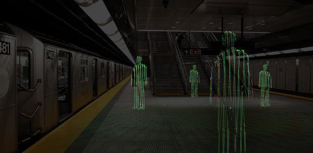
LiDAR
An invisible laser beam with 360 by 270 degree coverage constantly scans the space with high dimensional accuracy, resulting in real-time 3D change detection.
![]()
Video
A twin video camera system monitors the same area as the LiDAR system, and includes on-board video sequence recording.
![]()
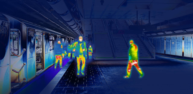
Thermal
Four thermal cameras monitor the space for all temperature changes.
![]()
AI & Edge Computing
The BLK247 uses onboard assistive AI and edge computing to analyze the data it gathers. It then distinguishes between a threat and a non-threat and decides whether to trigger an alarm.
![]()
Sensor Fusion
The BLK247 combines the power of LiDAR, video, thermal imaging, and assistive AI to trigger alerts and alarms. LiDAR determines whether an intrusion took place and verifies with other sensors if it is a human intruder.
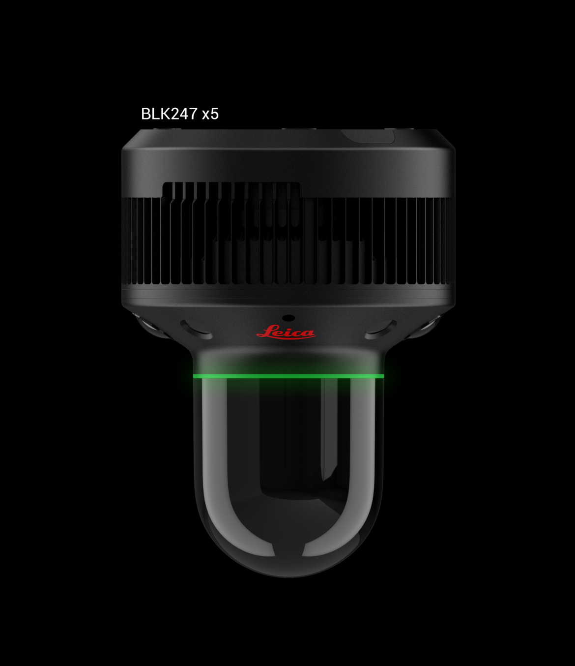
BLK247 x5 has four thermal cameras that monitor the temperature in a scene and can be used in both exterior and interior environments.
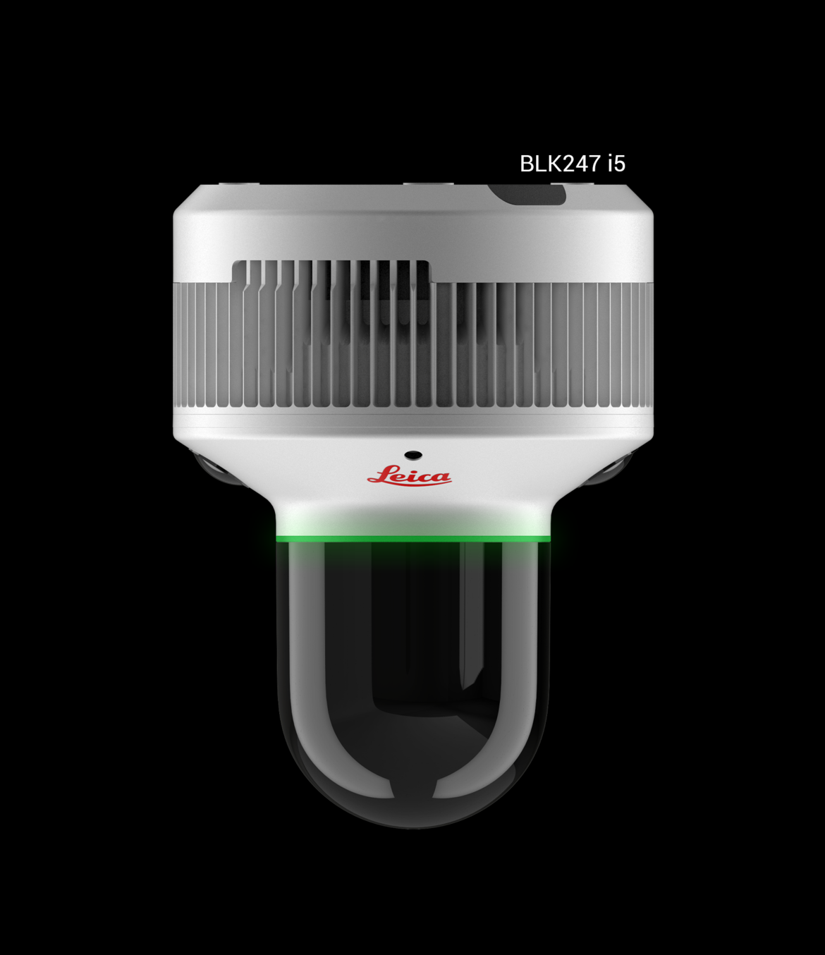
BLK247 i5 is ideal for indoor environments that do not require dust and water protection or thermal imaging.
DESIGN & PHYSICAL (x5 & i5)
HOUSING:
x5: black powder coated aluminium
i5: white powder coated aluminium
HEIGHT:
189 mm (7.44 in.)
WEIGHT:
x5: 1460 g (3.218 lbs.)
i5: 1380 g (3.042 lbs.)
DIAMETER:
Bottom part: 140 mm (5.5 in.)
Lighthouse: 80 mm (3.25 in.)
ELECTRICAL SPECIFICATION (x5 & i5)
POWER SUPPLY:
Power consumption: 51 W(max)
Power supply options:
- Power over Ethernet (PoE + +); IEEE 802.3bt, Type 3, Class 6
- Power supply over I/O port 48 V DC 1.06 A
ALARM OUTPUT I/O CONNECTOR:
Solid state relay
Max. working voltage 40 V DC/AC
Max. switch current at different working voltages:
- 5 V: max. 200 mA
- 12 V: max. 100 mA
- 24 V: max. 50mA
RGB IMAGING & VIDEO (x5 & i5)
IMAGE SENSOR:
2-camera system, RGB
TYPE:
Fisheye lens
SINGLE CAMERA RESOLUTION:
12 megapixel
FIELD OF VIEW:
360° x 180° (stitched image)
STREAM RESOLUTION:
1080p / 720p
FRAME RATE:
10/15/20/25/30 fps
H264 PROFILE:
HIGH / MAIN / BASELINE
IMAGE ADJUSTMENT:
Auto
PRIVACY MASKING:
Black/white
LiDAR (x5 & i5)
LASER CLASS:
Laser Class 1 (in accordance with IEC 60825-1)
WAVELENGTH:
830 nm
FIELD OF VIEW:
360° x 270°
RANGE:
30 m (98.4 ft.)
POINT MEASUREMENT RATE:
200,000 pts/s
ACCURACY:
6 - 10 mm (0.24 in. - 0.39 in.)
ENVIRONMENTAL (x5 & i5)
IP RATING:
x5: IP55/65/67
i5: ---
OPERATING TEMPERATURE:
x5: -15° C to 40° C (5° F to 104°F)
i5: 10° C to 35° C (50° F to 95°F)
STORAGE TEMPERATURE:
-25° to 70° C (-13° to 158° F)
HUMIDITY:
Max 95% non-condensing
WORKING ALTITUDE:
Unlimited
IR IMAGING & VIDEO (x5 only)
IMAGE SENSOR:
4-camera system
EMMISIVITY:
Adjustable
SINGLE CAMERA RESOLUTION:
80 x 64 pixel
FIELD OF VIEW:
360° x 136° (stitched image panorama)
88° x 70° (1 single image panorama)
MEASURABLE TEMPERATURE RANGE:
-20°C to 1000°C (-4° F to 1832° F)
STREAM RESOLUTION:
720 x 480
FRAME RATE:
2 fps
CONTROL CENTER FEATURES (x5 & i5)
- Recommended web browser: Google Chrome™
- General device settings
- Device status
- Definition of restricted areas
- Scheduling of restricted areas & feature activation
- Events list and download of event attachments
BLK247 AI - Object Classification
- Classification Categories: Human/Non-Human
- Classification Basis: LiDAR data
- Classification Range: 0-25m
- Processing: Off device on external computer
- Activation: License based solution
- Compatibility: Any BLK247
Now Available
Please fill out the form below to receive updates and news on the BLK247. To learn more about pricing, compatibility with VMS, or anything else, add your questions in the comment box and a product specialist will contact you.

